
It’s starting to feel like the end of our tour is too near as we circled back to Christchurch today so that we can catch our last train tomorrow.
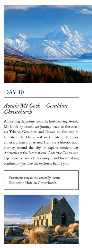
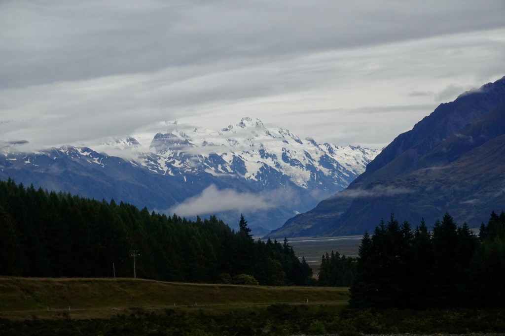
We had an early and rainy start to our day, making everything intensely green. Through a rain-streaked window we got one last glimpse of majestic Mount Cook.
The rolling landscape brought to mind grade 6 geography lessons about eskers, the characteristic sloped hills created by moving glaciers, although back then the concept of glaciers was associated with a far distant ice age; I don’t suppose that at 10 years old I realized that glaciers still existed. I certainly had a much different childhood than Sarah Hillary’s!
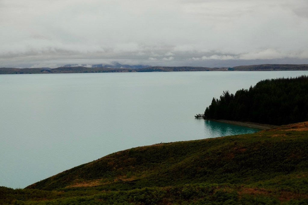
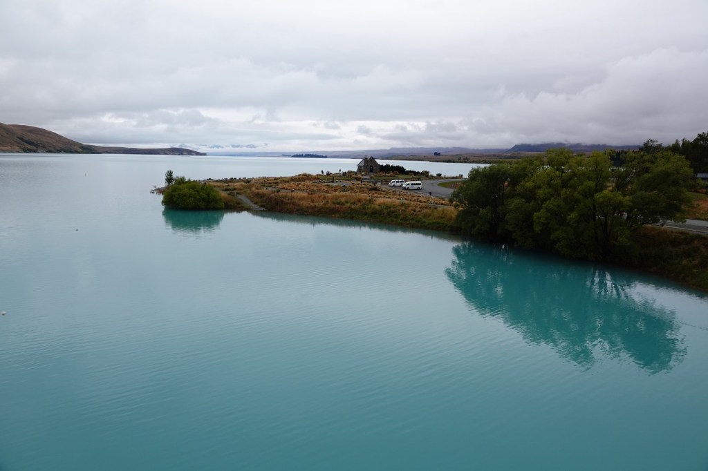
By the time we neared Lake Pukaki the sun was bravely fighting its way through the clouds, making the snow caps glisten.
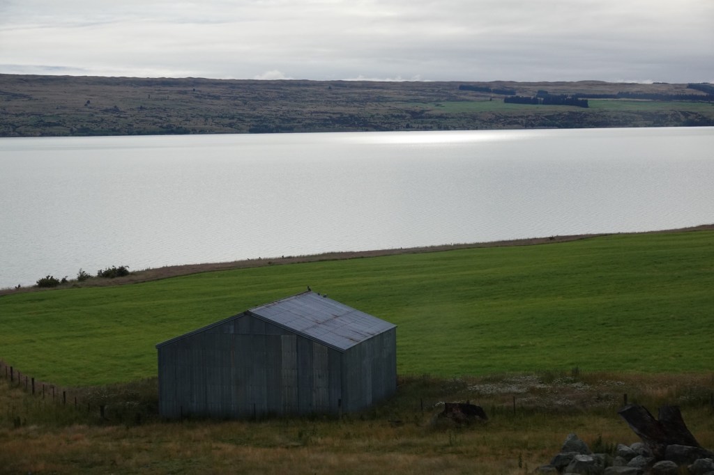
We marvelled anew at how high the lake level was, reaching well up the trunks of trees that would normally be above a rocky shoreline. At times the water almost reached the level of the road.
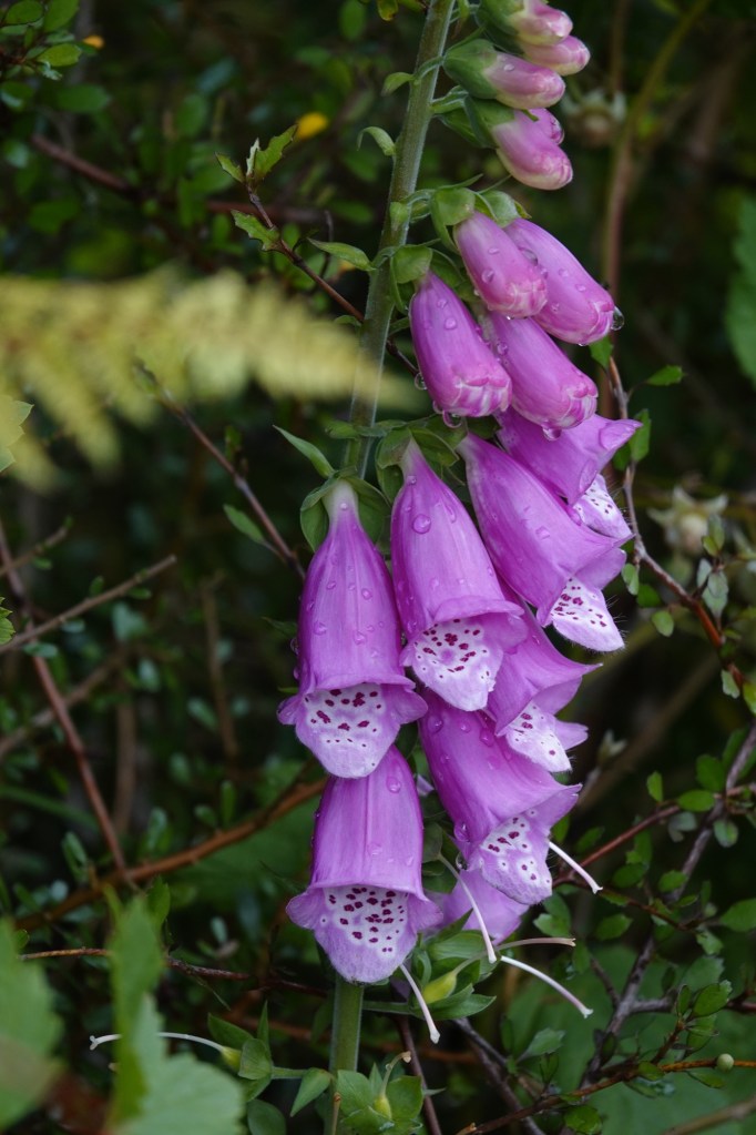
On our drive we talked again about the challenges New Zealand faces in ensuring that it stays as beautiful as it is. There are a staggering 25000 introduced plant and animal species vs just 2300 indigenous ones in New Zealand. The struggle to protect the native flora and fauna to maintain a healthy ecosystem is very real here. As tourists, we don’t instinctively understand the issue. For instance, the beautiful multicoloured flowers we admired as growing “”wild” on our walk yesterday were colonist-introduced foxglove; not only are they poisonous, but they also take over the rocky areas that native ground birds would otherwise use for nesting.
I suppose realistically that nowhere can be returned to its primeval state, but the prevention of further deterioration of landscapes and further species extinctions is a worthy goal.
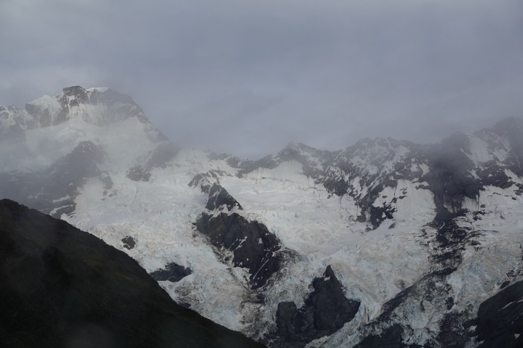
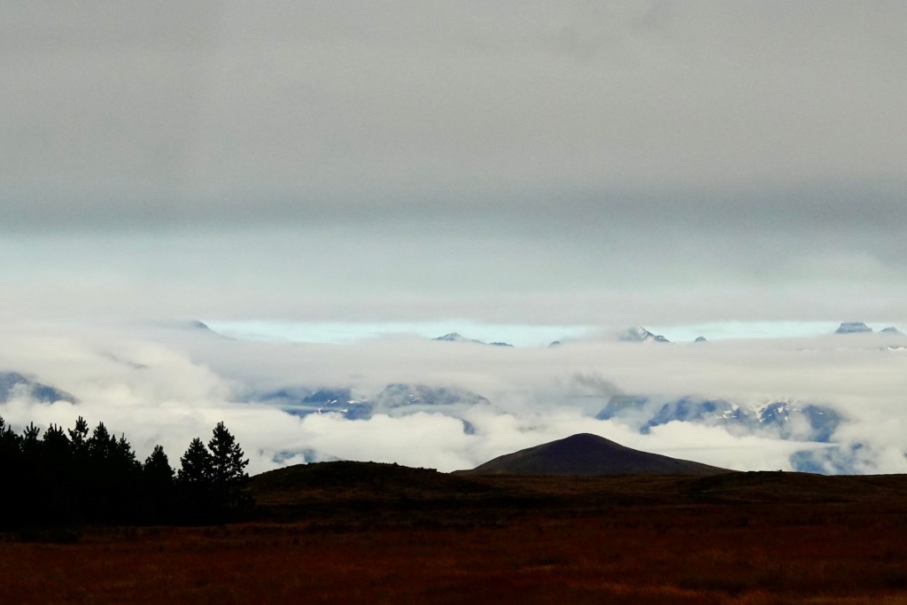
The cloudy skies created some interesting views. In one case, the strip of blue sky peeking through between two layers of cloud looked like a floating glacial lake.
Our morning stop at Lake Tekapo Village allowed us to see the famous Church of the Good Shepherd. There is also an observatory on the hill here, supported by a “low light pollution” ordinance in the township, but it is the church that draws tourists from all over the world.
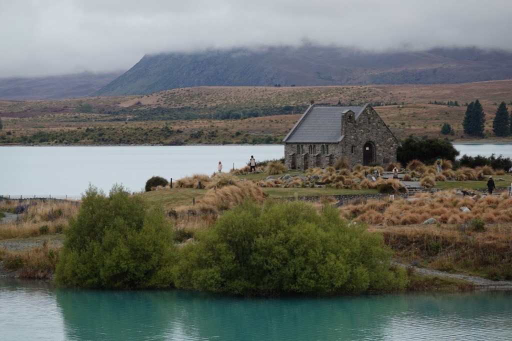

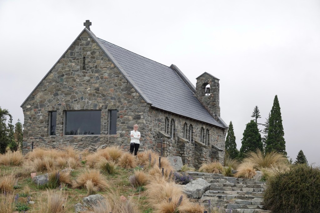
The sign at the church reads: “This modest stone church was built firstly to the glory of God and secondly, as a memorial to the pioneers of the district. Designed to give the impression of quiet strength and simplicity it embodies the essential qualities of the early settlers who endured the tough Mackenzie environment.A place of worship, the church is available to all peoples to sit quietly, pray or meditate.”

We’ve read people on-line complaining about the number of tourists who visit this site, but given that the town has huge signs indicating “historic church and statue this way ➡️” it’s hardly surprising.
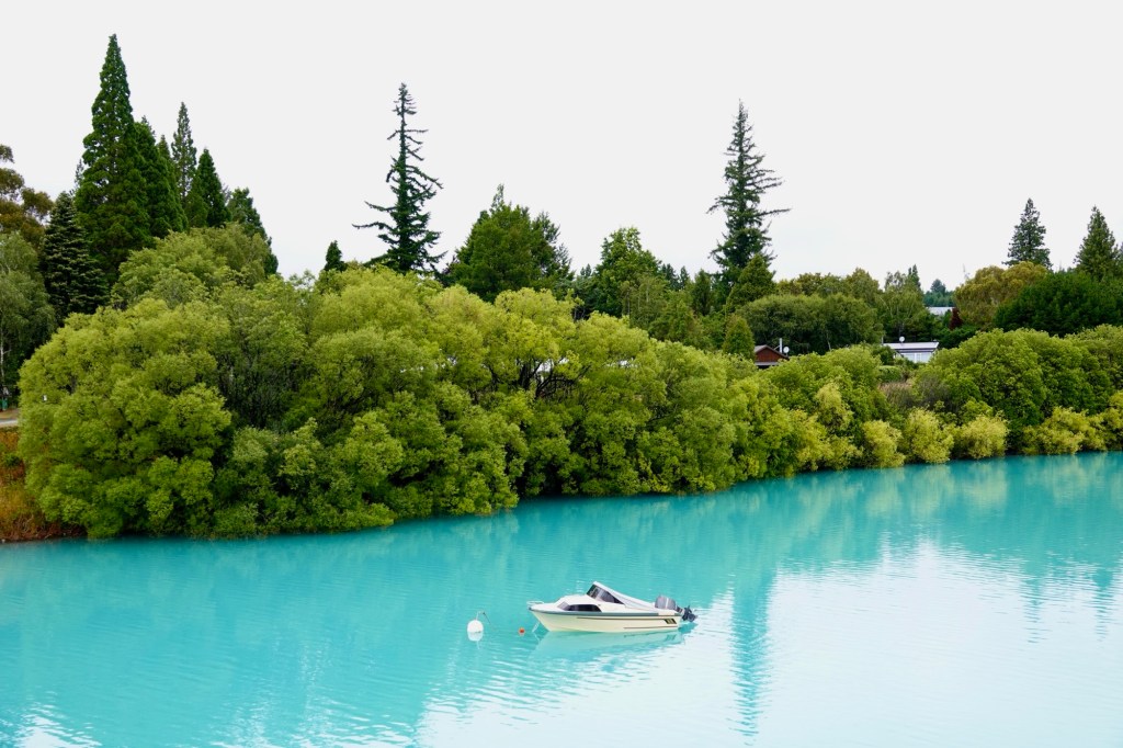
The church is certainly picturesque, but the turquoise glacial waters were what captured my attention and imagination. How like a perfect Impressionist painting the colours are!
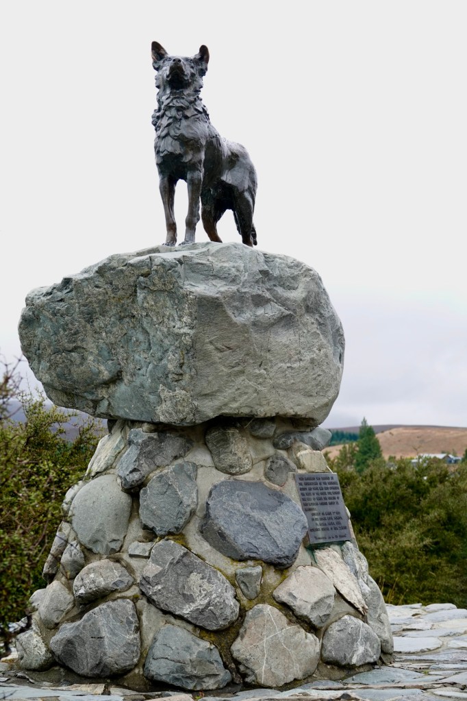
Just past the church is a statue of Friday, the dog of a famous Scottish sheep rustler. James Mckenzie (in Gaelic Seumas MacCoinnich), born in Scotland in about 1820, was an outlaw who has become one of New Zealand’s most enduring folk heroes. Mackenzie and Friday were caught in the 1850s with 1000 “allegedly” stolen sheep. Still, a monument was erected to him in Fairlie for rebellion, loyalty, and entrepreneurial spirit, and an entire valley basin region named after (and possibly by) him. How quintessentially Kiwi!
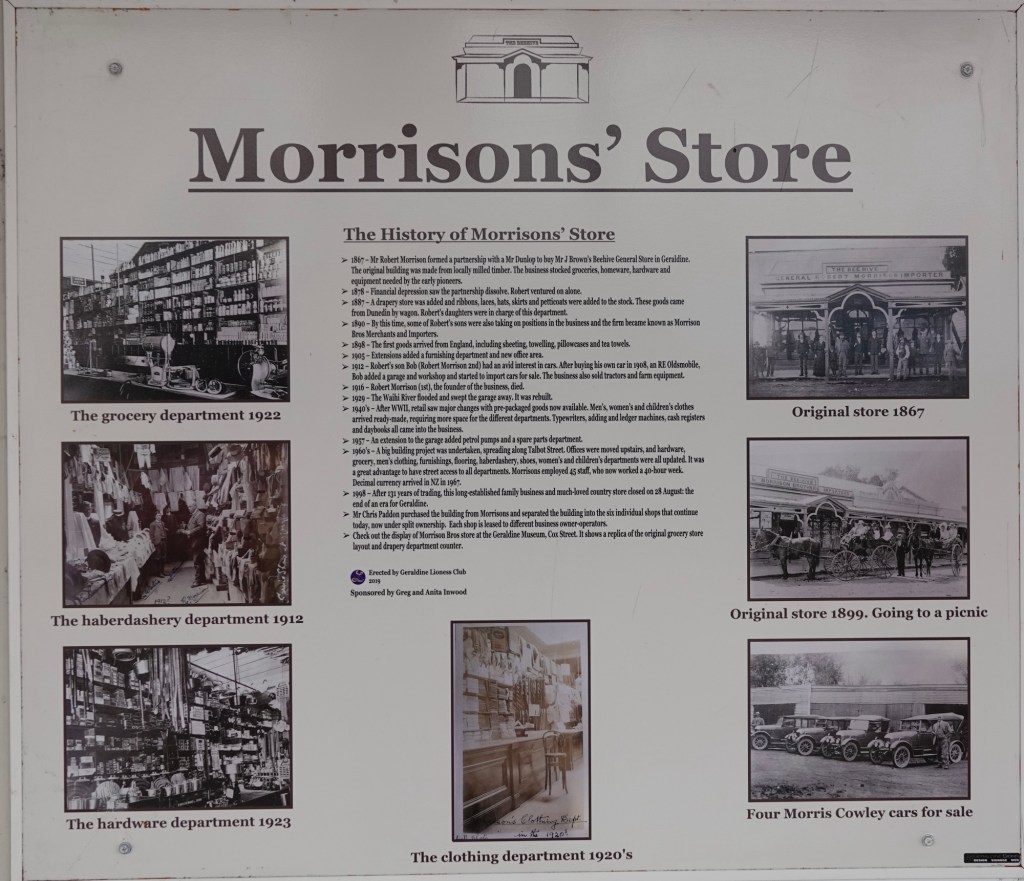
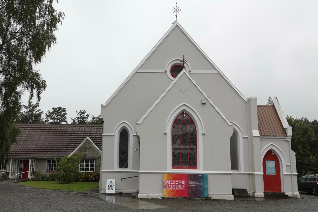
On the way to our lunch stop in Geraldine, our driver Steve regaled us with anecdotes about his childhood visiting his Morrison cousins here. When we reached the township we saw the plaque commemorating the family’s general store, which was the mainstay of the town for many years.
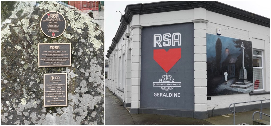
The town had a quaint and lovely main street with lots of independent shops, a boutique gin distillery, and the local branch of the RSA (the equivalent of Canada’s Royal Canadian Legion).
There was also a fabulous home-made gelato shop where – before our tasting lunch at Barker’s food emporium – we indulged in banana stracciatella (me) and whiskey & vanilla (Ted) cones. I’m becoming quite obsessed with New Zealand dairy. The mix of Fresian, Holstein, and Jersey milks makes for especially delicious ice creams and gelato.

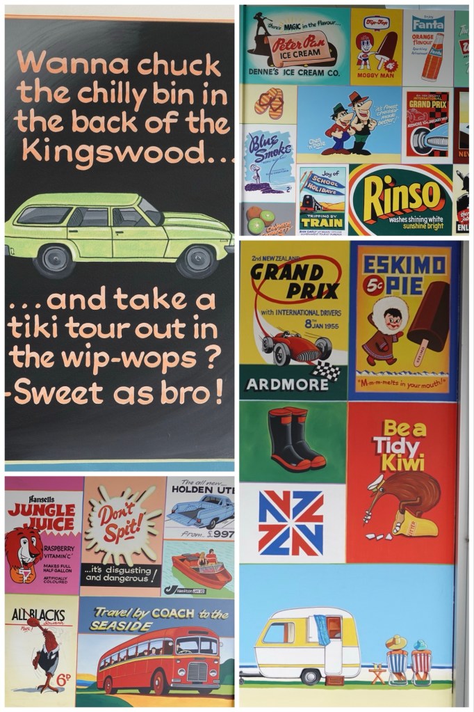
There were also some fun vintage signs.
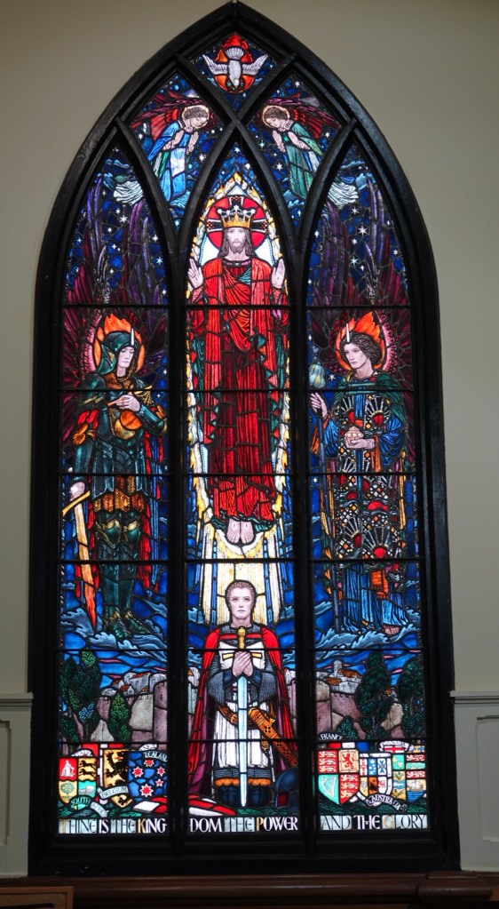
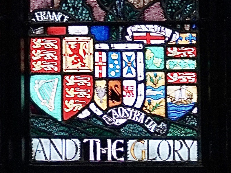
Inside St. Mary’s Anglican Church was a gorgeously detailed stained glass window commemorating those lost in WWI. At the bottom right corner was its Canadian component.
After lunch our journey took us through the flat dairy grazing region called the Canterbury Plains, where we continued to see more pivot irrigators over the fields than I’ve ever seen on any of our other travels. These plains are the largest flat area on the South Island; more than a 100km/67mi long stretch of alluvial plains over aquifers that supply the water both for drinking and for irrigation. That stretch of flat land is nothing compared to the Canadian prairies, but on this mountainous island it is huge.
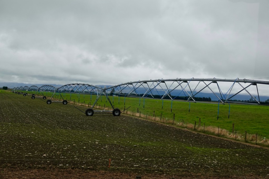
These huge irrigators, some with as many as 20 spans of 35m/125ft each (although most are 5-10 spans), create massive circular or semicircular paddocks of green, which I can imagine seeing from above as one of Edward Burtynsky’s signature aerial photographs.
From there we headed to our afternoon comfort stop at Rakaia (the place where people were ranged by rank) a drive made unique by taking place over the South Island’s longest straight stretch of road: 50km/30mi. Mike sharing that fact reinforced just how twisty the roads we’ve been on so far have been.
It was raining, so our stop really was just to use the toilet facilities , but they were yet another of the incredibly clean and well equipped public toilets we’ve encountered all over New Zealand. It makes us think that Kiwis must be much more respectful of their public facilities than typical North Americans.
Christchurch is the second largest city in NZ, and certainly looks the most modern, since over 100,000 buildings had to be demolished after the devastating earthquakes of 2010 which destroyed much of the city. Rebuilding the city gave municipal planners the opportunity to design the core anew, resulting in beautiful community-centred spaces, and earthquake-resistant building codes.
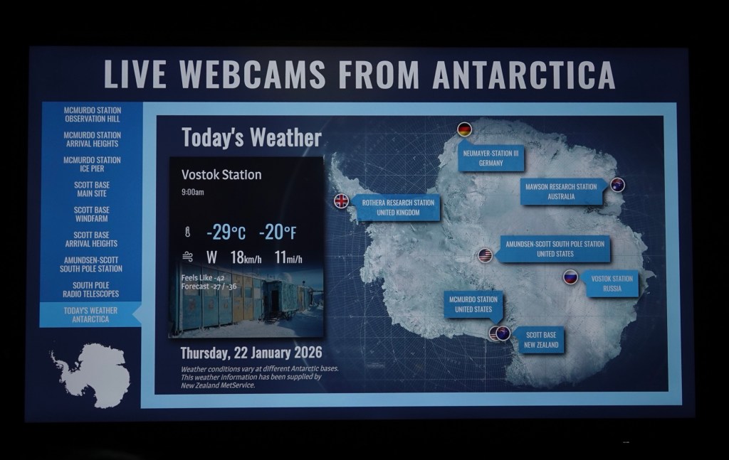
When we reached Christchurch, we disembarked at the International Antarctic Centre for a guided tour while some others in our group chose a tram ride through the city.

The jumping off station for the US, Italy, Japan, and New Zealand crews headed to Antarctica is right here at the Christchurch Airport!
Antarctica, unlike the Arctic, is a true land continent, and home to 70% of the world’s fresh water.
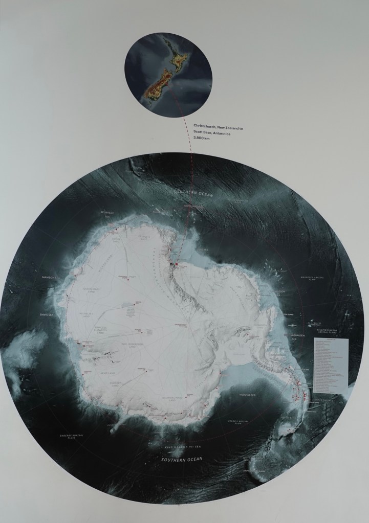
We were reminded about how huge the continent is: 1.5 times as big as the USA, 1.4 times as big as Canada, and 53 times as big as New Zealand!
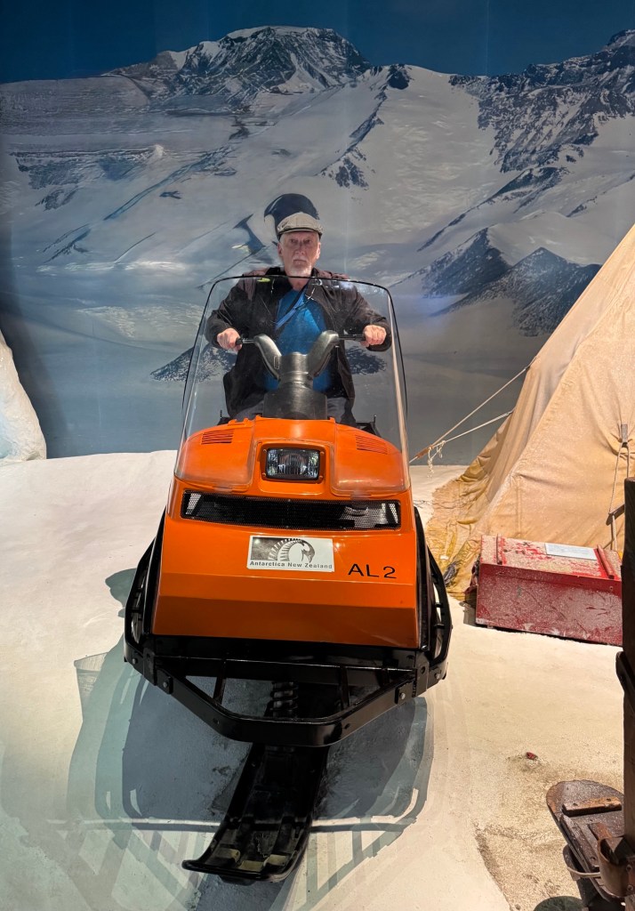
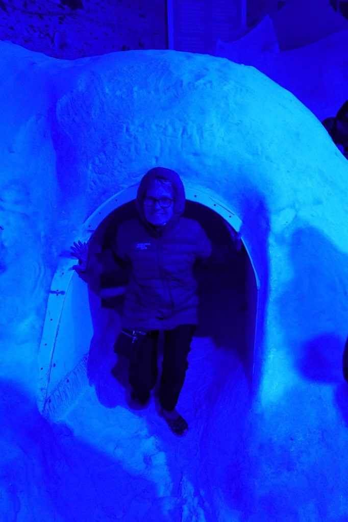
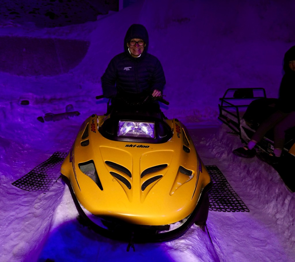
We got a full Antarctic immersion:
- sitting on sledges and Skidoos,
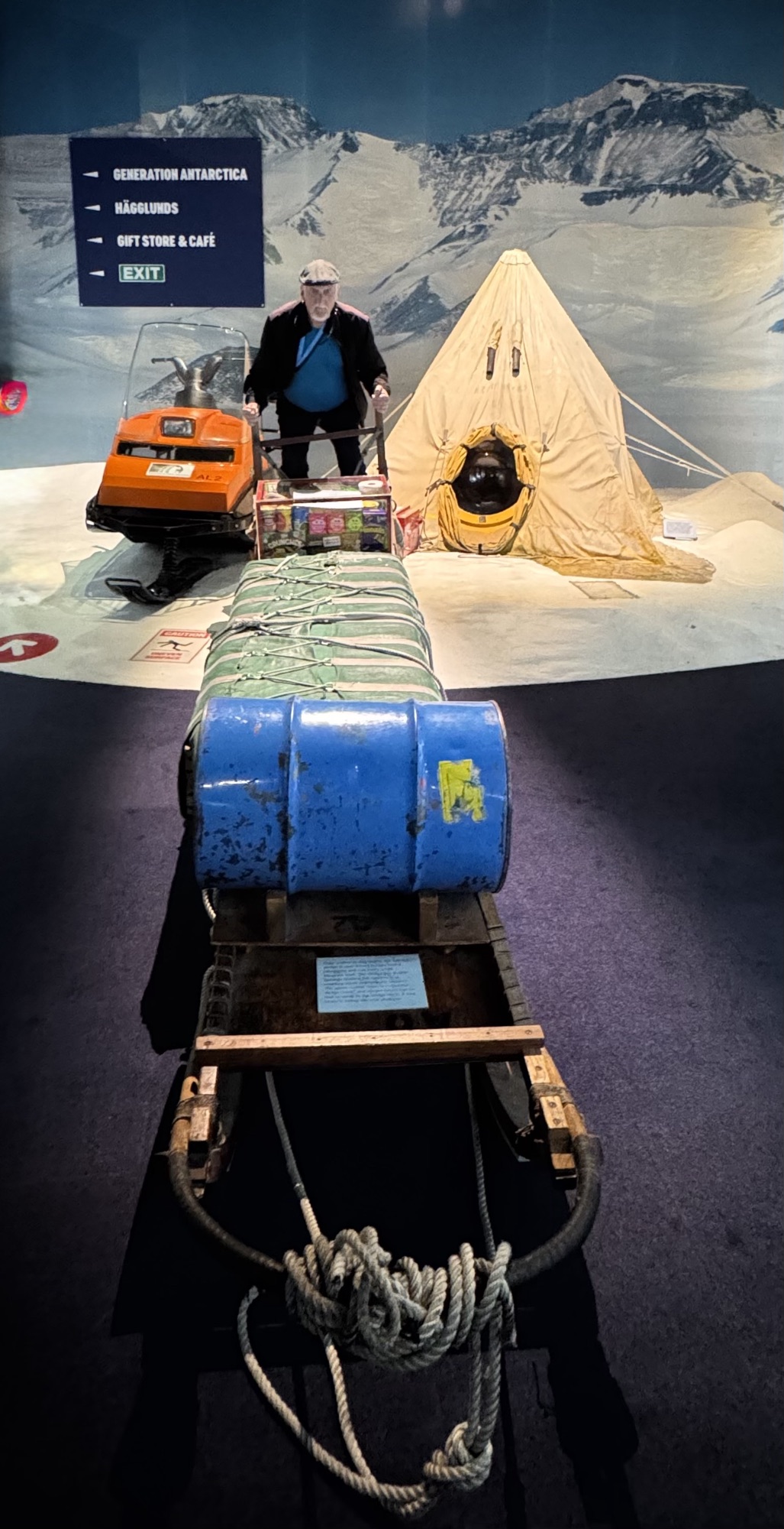
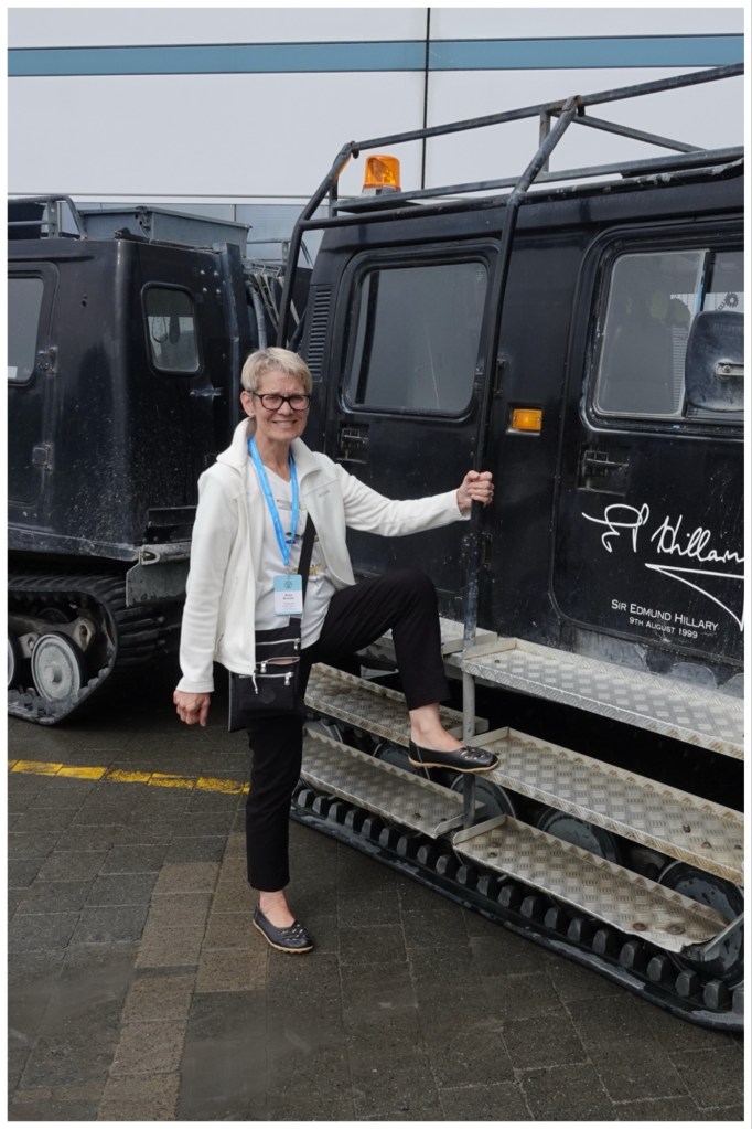
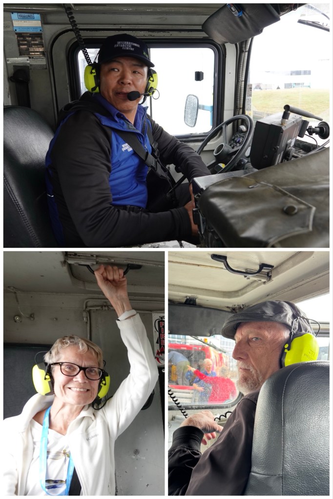
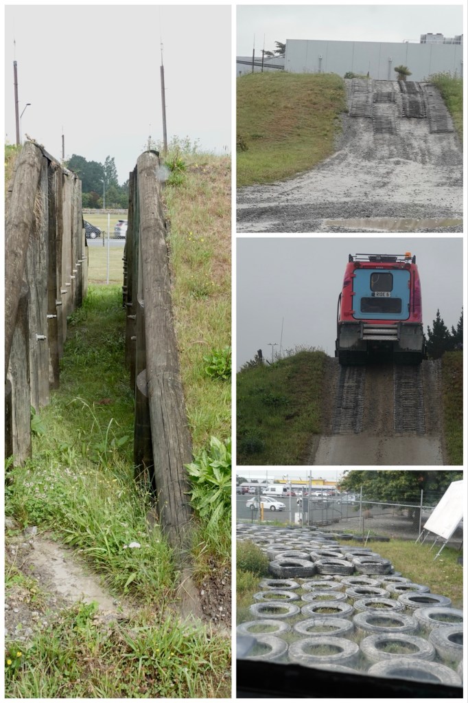
- riding in a Hägglund driven by a Sherpa over a simulated Antarctic landscape,
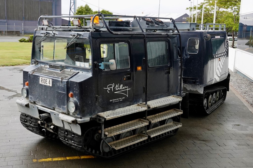
The Hägglunds with their high suspension are not the easiest vehicles to climb in and out of.
The course was set up with gaps to simulate crevasses in ice fields, steep 45° ramps and slopes to mimic Antarctic terrain, tires used to create “snow hills”, and deep puddles to demonstrate the vehicle’s ability to travel through melt. It was a bone-jarringly bumpy ride. Antarctic exploration is not for the delicate.
- donning jackets to experience an Antarctic windstorm (the windchill today in the “summer” storm room was -18°C )
- learning about the centre’s currently moulting (and therefore very shy) rescued blue penguins,
- experiencing a 4D movie that took us through the Drake Passage and to Georgia Island for 7 minutes. We’ve sailed there, but for us it was the “Drake Lake”. The movie’s footage of sculpted ice and clear waters was inspiring. The special effects meant we experienced wind, waves, sea spray, snow, penguins right in our faces, aggressive seals, and more!
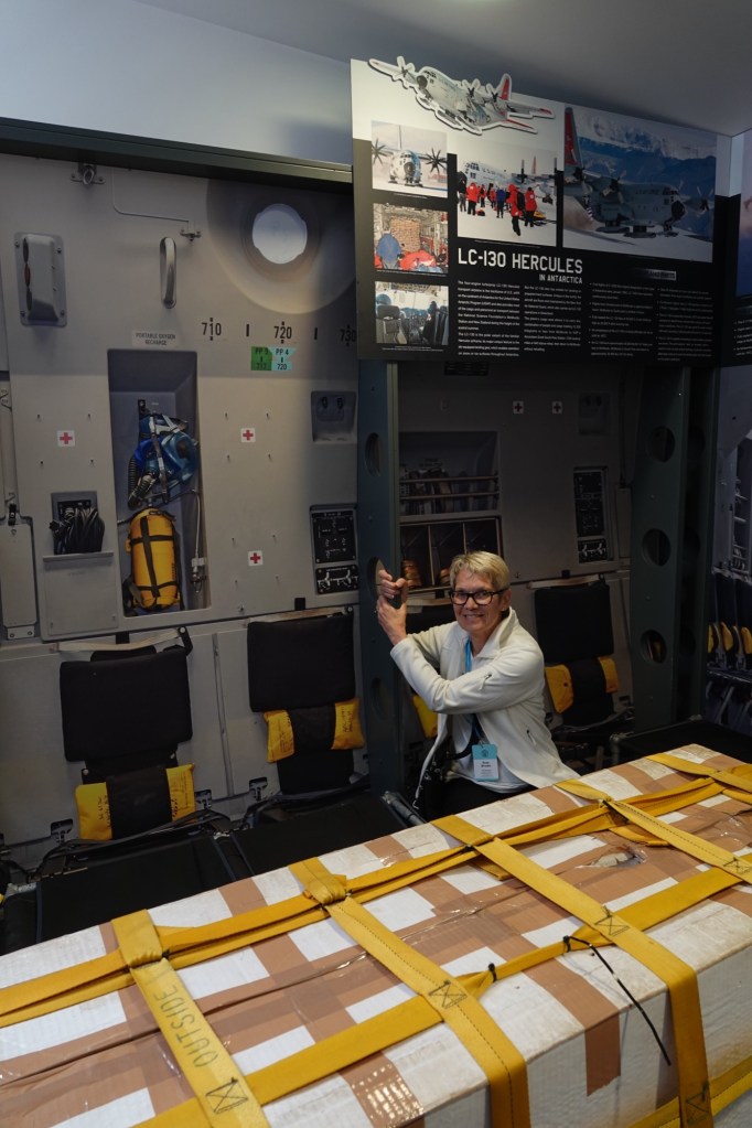
- and sitting in the replica cargo hold of a a flight to Antarctica, which reminded me of son #2’s stories of being strapped to the walls of a C130 Hercules (just like this one!) when being deployed to Afghanistan with the RCAF.
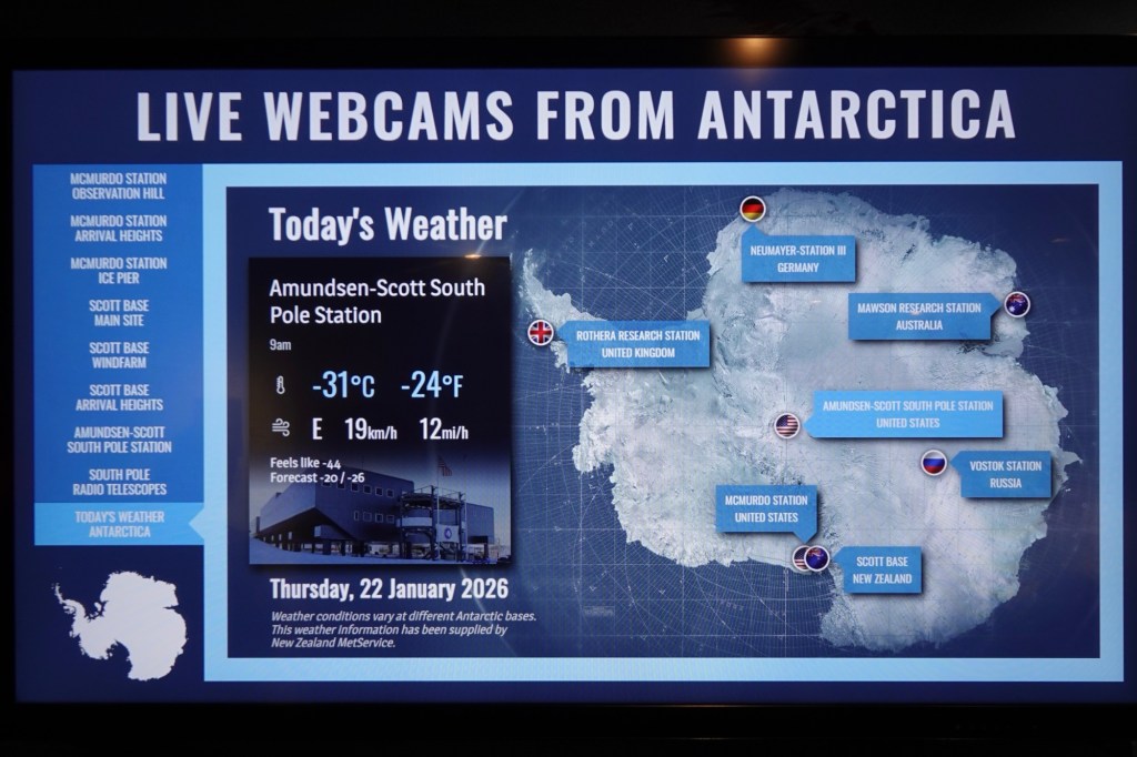
There was live webcam feed from the various scientific stations. We learned that each Antarctic station operates on the time zone of their own country! That makes communicating scientific data back “home” convenient for everyone.
It’s an incredible and incredibly interesting facility.
After all that fun, some sobering information.
A short film we watched called ”The Climate Canary” showed how important research in Antarctica is, especially around what happens when sea ice disappears: algae, plankton, penguins, seals, and even whales are effected by a disrupted food chain.
Earth’s temperature/climate changes are felt least at the equator, and most at the poles. Those doing their research in Antarctica are keenly aware of how fragile our ecosystems are, and how important it is for all of us to do what we can to mitigate our own impact on our world.
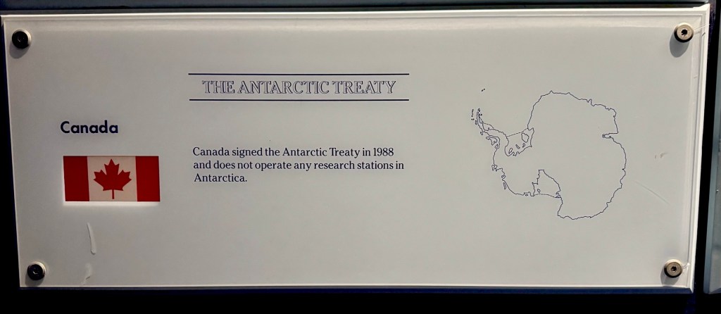
The initial Antarctic Treaty was signed on December 1, 1959, by 12 nations that were active in Antarctica; Argentina, Australia, Belgium, Chile, France, Japan, New Zealand, Norway, South Africa, the Soviet Union, the United Kingdom, and the United States. These countries agreed to preserve Antarctica for peaceful, scientific purposes, setting aside territorial disputes.
Since the 1991 Madrid Protocol, the continent has become a fully protected place, and a model of peaceful collaboration. It belongs to no one and benefits all humanity.
The Treaty now includes 56 nations.
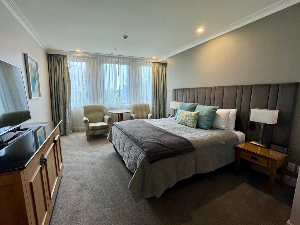
Dinner and overnight were at Christchurch Distinction Hotel, the third hotel in the Distinction chain during this tour. We were very pleased with the other two, and this one is no exception.
Tomorrow is the earliest start we’ve had yet: out by 06:00 a.m. with breakfast on board the train to Picton.

I loved the photos with you and Ted. I am so sorry you did not get a clear view of Mt. Cook. When we were there all the rooms faced the mountains, did they add on?
LikeLike
All the rooms did indeed face the mountains
Sent from my iPhone
LikeLike
What an amazing trip you two are on! I so admire how you embrace every bit of it!
LikeLiked by 1 person
It’s a world worth embracing!! We’re beyond blessed.
LikeLiked by 1 person
So is Antartica next? We keep looking
LikeLike
Ted would love it I think, but the cost and cold combined with my seasickness probably mean no
Sent from my iPhone
LikeLike
That’s right I forgot about your mal de mer 😢ClayFollow and keep up with our retirement adventuresInstagram: @ClaynMike
LikeLike