Glacier Bay is the world’s largest water-based national park, and encompasses over 1000 glaciers.
Park Rangers Tom and Adam joined the Koningsdam via “controlled collision” (yup, really) at 6 a.m.. Ranger Tom described their boarding process as “friendly pirates”: their small boat came alongside, bumped the ship, climbed up a rope ladder, and “boarded” us. They stayed with us until noon, narrating our sail through Glacier Bay.
As we began our exploration of Glacier Bay, Ranger Tom touched on the uneasy transfer of stewardship of these lands, in the 1920s, from the Tlingit people to the National Parks Service. The two entities now work together to ensure the preservation of this area.
We were allowed to access the bow on deck 5 all morning. The Koningsdam’s bow is surprisingly small, but fortunately people moved on and off to allow everyone who wanted a close-up view to access it. I’m sure the rain and cold did’t hurt – very few people wanted to spend extended amounts of time outside. We were surprised, given how slick the surfaces can become, that there was a combination bar/coffee station set up on the bow; alcohol and a slippery deck seem like an unwise combination. They also served Dutch pea soup. We found the fog pea soupy enough (Ted’s camera couldn’t even get a lock on Johns Hopkins or Grand Pacific).
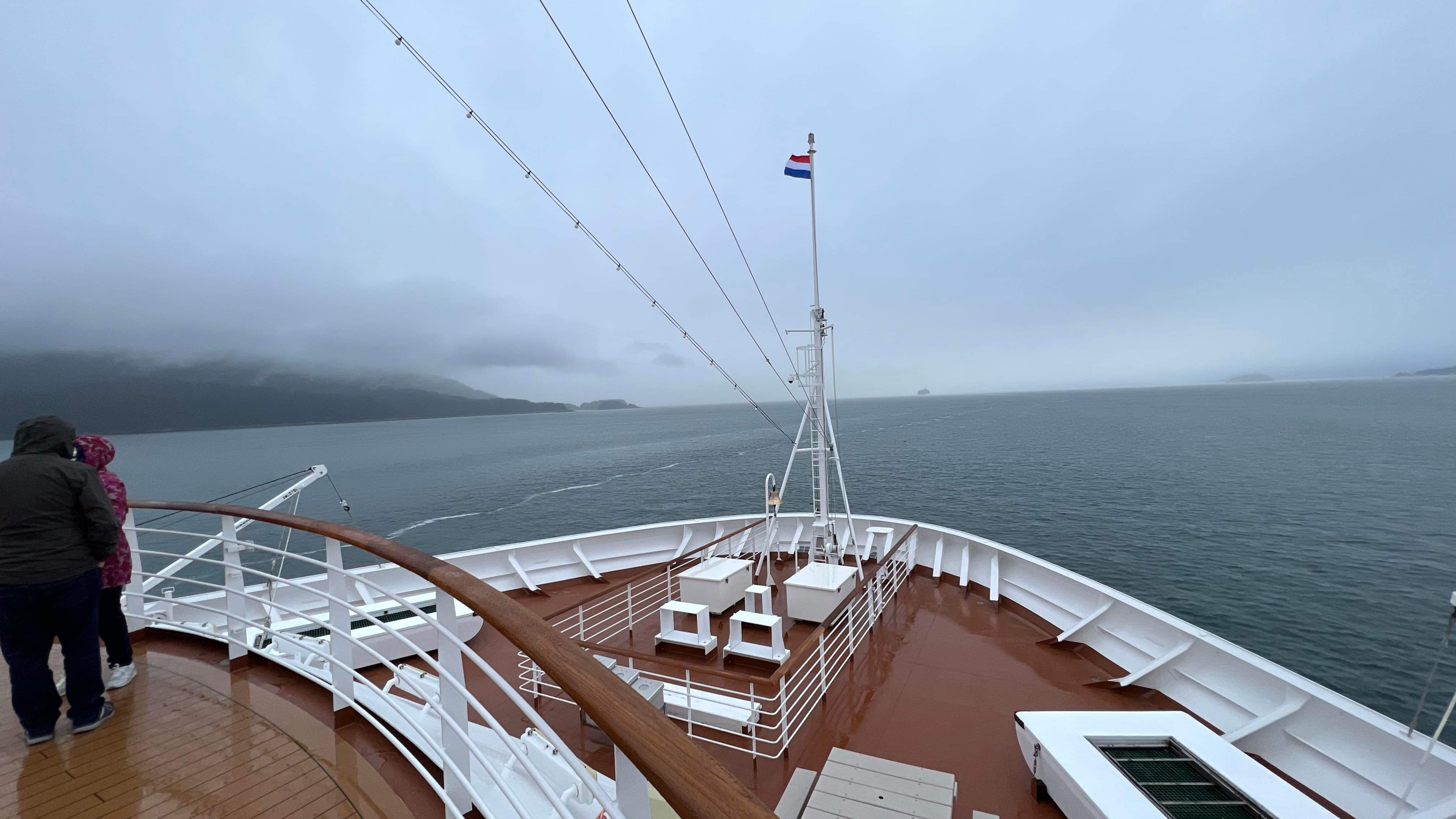

(Below) Heading into Blue Mouse Cove in the mist. Ranger Tom explained that we are actually “chasing” a huge glacier on our route. Just 250 years ago (no, there are no zeros missing!) we’d have been on ice! 250 years ago, Glacier Bay was a massive river of ice, about 100 miles long and thousands of feet deep. There was no “bay”. As the ice retreated, salt water filled in the void left behind, creating the bay, fjords, and waterways. At the end of the “Little Ice Age”, about 1850, the area containing the national park had 150 glaciers. There were only 25 active glaciers remaining in the park as of 2022.

The Ranger talked about how the Tlingit have witnessed the changes in this region for 10,000 years, and in fact moved out of this area headed south to Hoonah when the glacier reached its maximum in around 1750. By the time Captain Vancouver sailed here 45 years later, the glacier had melted back by 5 miles into the “new” Glacier Bay, which it had gouged out. By 1879, when John Muir travelled here, the glacier had retreated 40 more miles up the bay. Our “chase” today took us 65 miles up the bay to reach our first visible tidewater glacier. Current predictions are that the glaciers we saw today will no longer be visible by 2030 – just 7 short years from now.
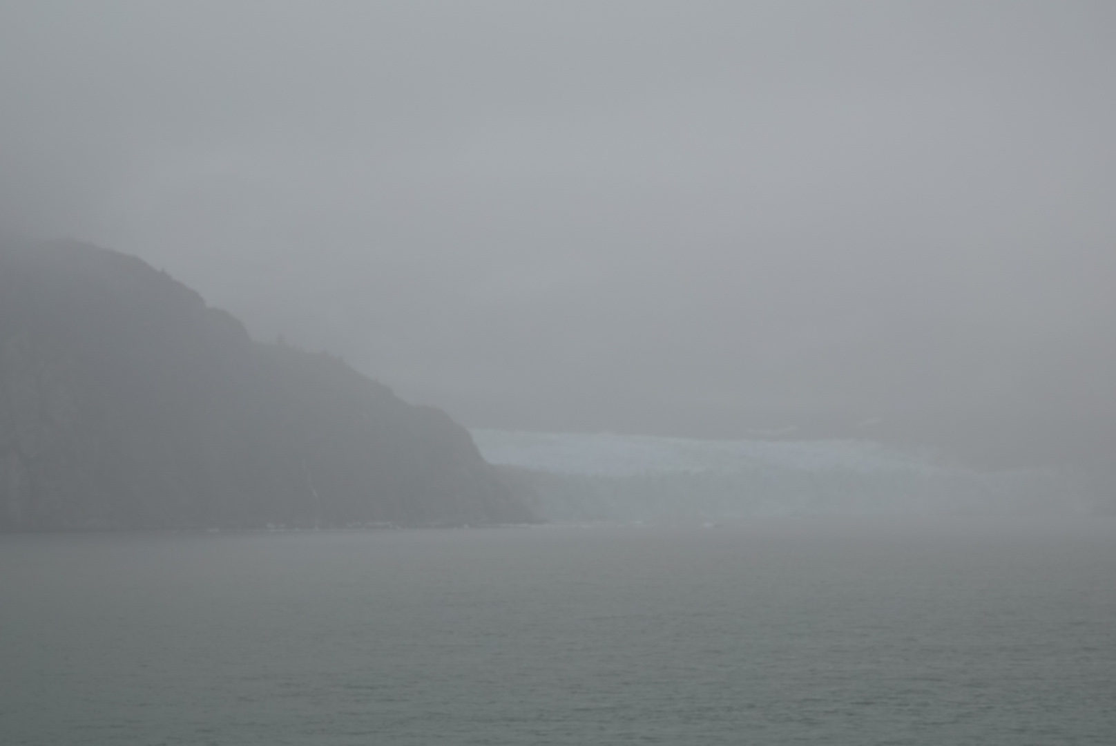
The first glacier we passed was the 11-mile-long Reid Glacier, shrouded in mist.

Next we reached 8-mile long blue-toned Lamplugh Glacier. The ranger reminded is that glaciers are very different from “ice fields”; glaciers are moving ice rivers rather than static accumulations. When silt and rock move with the water, the surface can end up looking “dirty”, but that meltwater carries importance nutrients that feed phytoplankton.

Heading past Jaw Point into Johns Hopkins Inlet, we reached the 12-mile long Johns Hopkins Glacier. This glacier is about 1-mile wide and 225-300 feet high at the terminus. It is formed from numerous tributary glaciers, many of which extend 12 or more miles into the surrounding peaks. In the light rain, the glacier disappeared in the grey.

Around noon we reached the Grand Pacific and Margerie Glaciers, on opposite sides of Tall Inlet, where the ship pivoted to get us back onto our route toward Ketchikan.
Grand Pacific Glacier originates in Canada’s St. Elias Mountains. It is the main glacier credited with carving out Glacier Bay. In the past 250 years it has receded to the head of Tarr Inlet, where the terminus is no longer tidewater, but a “wall” of layered ice. The ice has been thinning for the past few decades. The Ranger explained that what we saw was not really Grand Pacific; nearly all of the ice in the ice front is now from Ferris Glacier. A meltwater stream now separates Grand Pacific from Ferris Glacier, which contains a huge amount of rock and dirt that it has removed from nearby mountainsides, giving the ice its brown or ‘dirty’ appearance.
We got no useable photos of Grand Pacific/Ferris at all.
According to the National Parks Service website: “Margerie Glacier is found at the furthest reaches of Glacier Bay waterway, at the northern reach of Tarr Inlet. The glacier is picturesque in setting, carving a steep valley through towering mountain peaks, and ending dramatically at the edge of the sea.
Margerie is a more beautiful, “clearer”, glacier. The Ranger likened Margerie’s flow to churning rapids, which throw off any silt collected on their route. Sadly, the rain and fog precluded getting good photos.
We saw lots of sea otters alongside our ship. At one point, they’d almost been wiped out in this area, hunted for their incredible waterproof pelts. Now there are about 8,000 of them in the cold waters of the bay.

Since it reaches all the way to ocean water, Margerie Glacier is referred to as a tidewater glacier, defined as a glacier that interacts with ocean saltwater. Margerie glacier is about 21 miles long, originating in the Fairweather Mountain Range at elevations exceeding 9000 feet. Due to the abundance of snow in the mountains and the steepness of slope, the ice of Margerie Glacier flows relatively quickly, estimated to flow about 2000 feet per year, or about 6 feet per day. The glacier does not expand out into the fjord since it rests on an underwater ledge, so the ice falls into the ocean in a process called calving, breaking into icebergs. The icebergs become resting spots for harbor seals, sea otters, black-legged kittiwake gulls and other birds.”
What a treat, and wonderful educational experience, to be guided through this area by National Park Service Rangers.
Just after lunch (fried chicken for Ted, a porcetta and provolone sandwich for me, plus espresso chip gelato!) Ranger Adam gave a very interesting – and very entertaining – talk about the life under the bay’s water, from microscopic plankton to kelp and red coral, and of course sea otters and humpback whales.
Mid afternoon, after leaving Glacier Bay, the sun broke through. Figures.

Once the Rangers left the ship, there were no activities of interest to us (trivia, adult colouring, pingpong, daily mass, art scavenger hunt, and various shop promotions), so we just relaxed in our cabin until our early dinner seating. We could have had afternoon tea, which is offered in the main dining room on sea days, but Ted wasn’t interested and I’d already scarfed down that earlier gelato, so we really didn’t need or want more food.
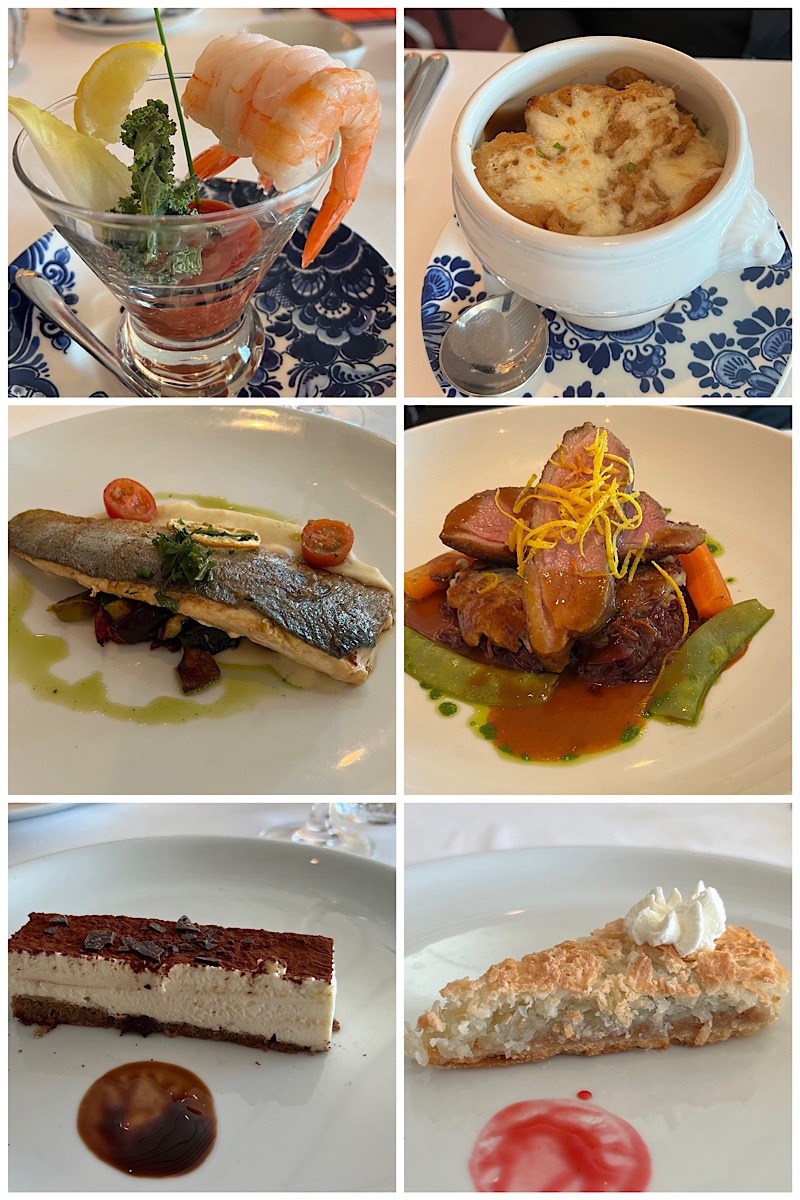
Centre: pan-seared Arctic char with parsnip purée, arugula oil, and roasted Italian vegetables; tangerine glazed duck breast with wild rice potato pancake, red cabbage, and snow peas.
Bottom: mascarpone tiramisu; dulce de leche coconut tarte.
Having missed Step One Dance Company’s first performance this week (“Move”), we made sure to attend tonight’s show, called Humanity: Technology and Dance Come Together to Awaken the Human Spirit. To say that the show was outstanding would be an understatement. Lights! Dance! Special effects! Music! It was like watching the best dance and tech group on America’s Got Talent for 45 minutes. Just… WOW!!! Probably the best show we’ve ever seen at sea, utilizing the theatre’s huge video screens on 3 sides of the theatre to further enhance the effects of the light show,


Leaving Glacier Bay and a beautiful sunset in our wake, we’re headed to Ketchikan….


Rose, could I trouble you for your Viking World Cruise packing list. I admired your purchasing local clothing en route and remember you’re getting thumbs up from guides. I’d like to follow your lead as to culturally appropriate clothing for WC 23/249. Thanks. Becky. Of Hawaii and NH.
LikeLike
Gladly! December 2021. Episode 140. https://roseandtedsexcellentadventure.com/2021/12/03/episode-140-overpacking-and-following-international-dress-codes/
LikeLike
Thank you kindly. Hope you kept warm & dry in Alaska
LikeLiked by 1 person
Hi Rose:
I’m so glad you and Ted are “on the road” (on a ship!) again! As always I’m thoroughly enjoying reading your blog.
I remember, a year or so ago, that you talked about the criteria you used when choosing locations for your extended stays. You talked about how you prefer locations in urban centres with good transportation, close to grocery stores etc. and I think you also mentioned your criteria for the Airbnb rentals. I have looked back through your blogs, but I haven’t been able to find that episode. Do you happen to recall which episode I’m talking about? If you do, I would love to read through it again.
Hope you continue to enjoy Alaska and that you have smooth sailing from now on!
Thanks,
Donna
LikeLiked by 1 person
What a good memory you have! That was way back in episode 6, October 2018.
LikeLike
Wow!!!! Great
<
div dir=”ltr”>
<
blockquote type=”cite”>
LikeLiked by 1 person
How wonderful having the park rangers aboard at Glacier Bay. Too bad about the fog. How sad it will be gone by 2030! Enjoy Ketchikan. My excursion was salmon fishing. It was shipped home for us. Very expensive salmon.
LikeLiked by 1 person
Our excursion is Totem Park. No chance of having one shipped home!! 😂
LikeLike
Haha! Salmon tastes better.
LikeLiked by 1 person
Sounds absolutely fabulous, Rose! I am really enjoying doing this trip with you.
B.
LikeLiked by 1 person
I’m so sorry for your bad weather.
<
div dir=”ltr”>
LikeLiked by 1 person