Itinerary: A day of splendid scenery as we tour the famous Ring of Kerry. We pass Daniel O’Connell’s Cahirsiveen, the fishing village of Waterville and Molls Gap in the heart of the Black Mountains.
☘️☘️☘️☘️☘️☘️☘️☘️☘️☘️☘️☘️☘️☘️☘️☘️☘️☘️☘️☘️☘️☘️☘️☘️☘️☘️
High 23°C/Low 10°C and … is this really Ireland? … sunny all day.
Today was a relaxing “scenic drive” day.
I hadn’t really appreciated how similar the landscapes of Ireland and Scotland are until today. When I look back at the photos of the lakes and mountains in the Ring of Kerry, without captions I’ll be hard pressed to differentiate them from the lochs and benns of Scotland’s Great Glen (Episode 29e).
The Ring of Kerry is 179km, or 111 miles, around the Inveragh Peninsula. By comparison, Nova Scotia’s Cabot Trail is 298 km (186 mi) long.
Our first stop on the Ring was Killorglin, home of the annual Puck Fair, Ireland’s oldest fair. The most popular legend has it that when Cromwell’s armies would approach the small towns in Kerry, it would disturb the wild goats, who would run down from the mountains into the villages. That “warned” the villagers and gave them time to hide (fighting Cromwell’s large well equipped armies being a futile and fatal option). However, there is no definitive information as to the origins of the fair. A less glamorous explanation is that it was simply an annual animal tally, taxation, and sale.
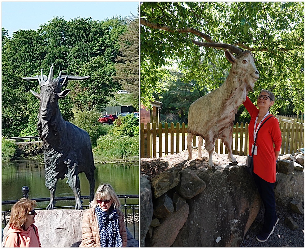
Nonetheless, there is a charter from 1613 by King James I granting legal status to the existing fair in Killorglin, which predates the Cromwell warning theory. Too bad.
The festival is held without fail on the 10th, 11th and 12th of August every year. In preparation for 3 days and nights of celebration (and, frankly, drinking), a wild goat is brought down from the mountains, well treated and well fed, crowned “King”, and displayed at the fair until being released back into the wild.
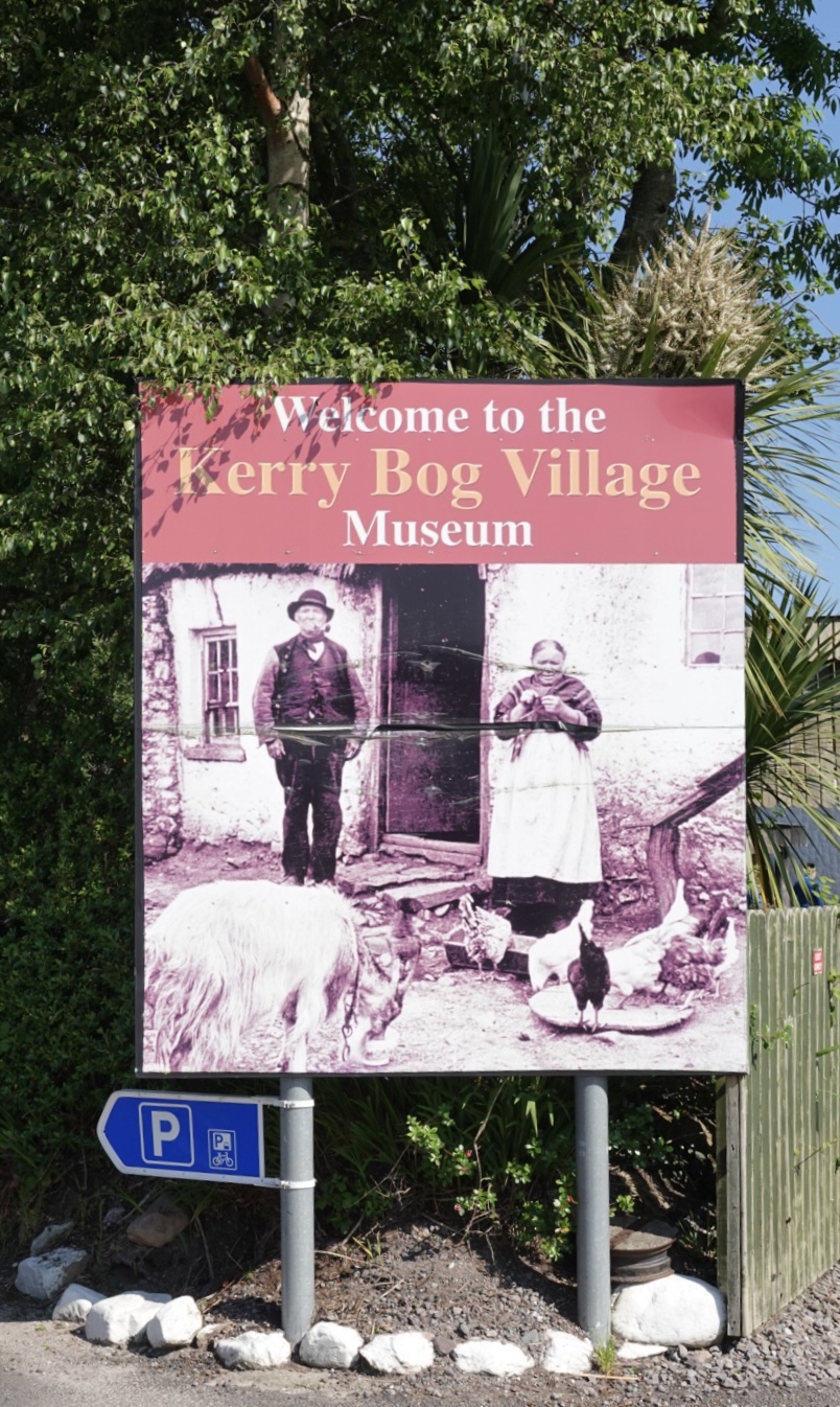
Our next stop was at Kerry Bog, where there is a small museum recreating an 18th/19th century village from the area.
Inside the museums entrance were a couple of Irish wolfhounds. These gentle giants only live to be 7 or 8 years old.

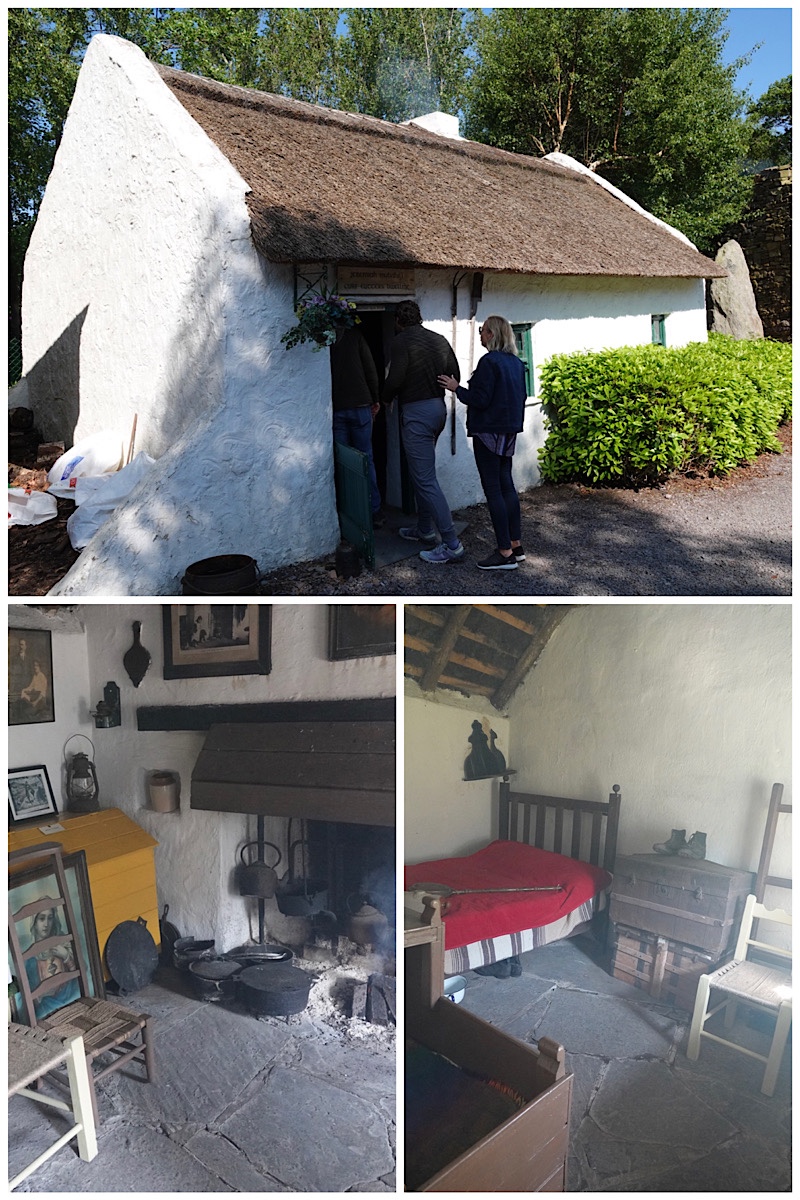
The first building in the museum was turf cutter Jeremiah Mulvihill’s cottage, thatched with river reed and floored with flagstones. Inside the ceiling we could see bog scraw, looking like mud and grasses, and used as insulation. A peat fire was burning in the cottage, filling it with smoke and a distinctive peaty smell. It’s hard to imagine an entire family living in this tiny space, but numerous family members would share a bed, and despite extremely high infant mortality rates, families were large. A peat cutter would not have been able to afford a big house.

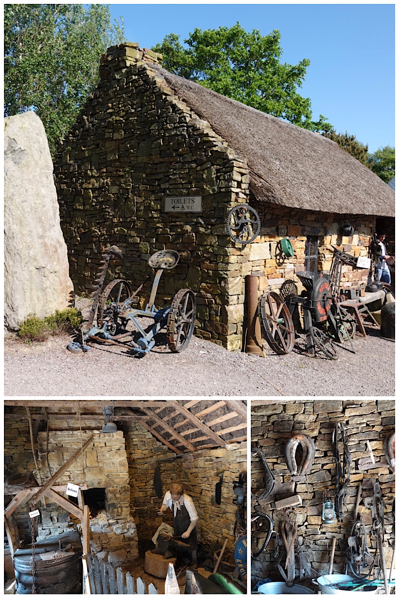
Next was the forge of Jack Sullivan, with thick stone walls, and ventilated with windows and chimneys. The dark interior actually helped the blacksmith recognize the colour of the horseshoes coming out of the fire.
The stable dwelling belonged to a successful farmer named Phil McGillicuddy. The stable was part of the house, with the heat from the animals helping to warm the side in which the family lived.
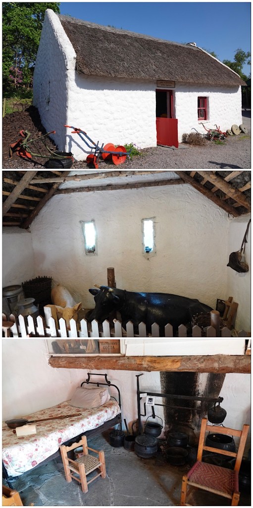
The stone henhouse with its corrugated iron roof was behind the stable house.

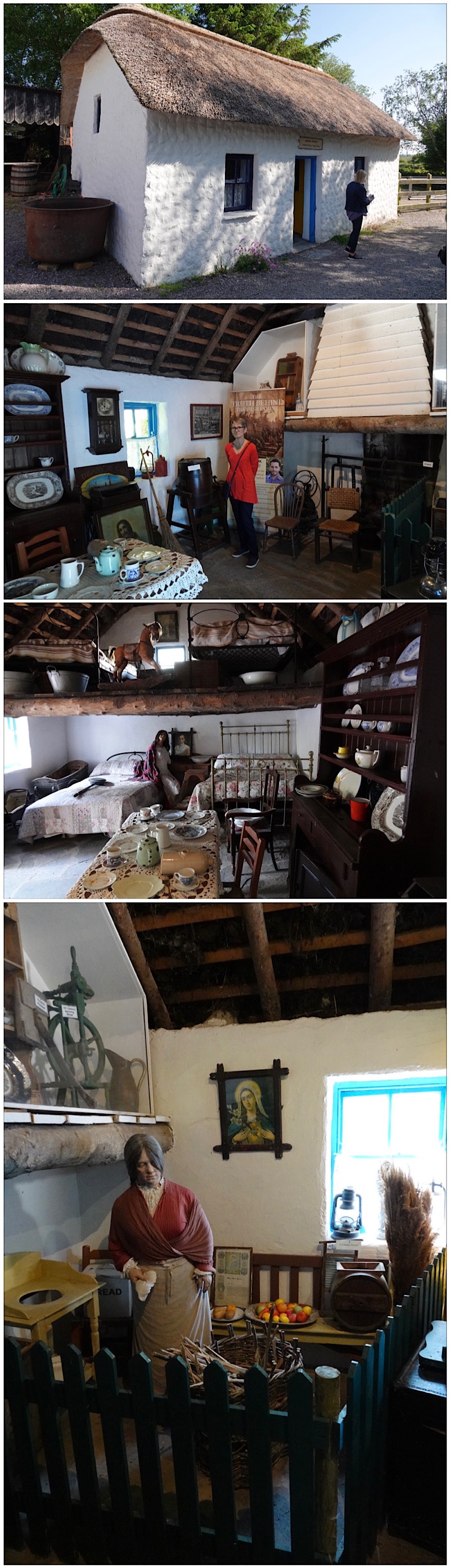
A tiny cottage belonging to unmarried labourer Denny Riordan seemed suddenly large compared to the turf cutter’s house which had to accommodate 6 or more people at a time. The tiny windows reflect the fact that under the English-imposed laws in Ireland, people paid more to have large windows since light was considered a “luxury”.

Moving up the status ladder, we next toured the much larger cottage of Paddy Browne, a local thatcher. His skills would have been in high demand in a fairly large area. His house featured multiple beds, an upstairs (no ladder displayed because… tourists), better quality furniture, and a larger fireplace, although still burning peat.
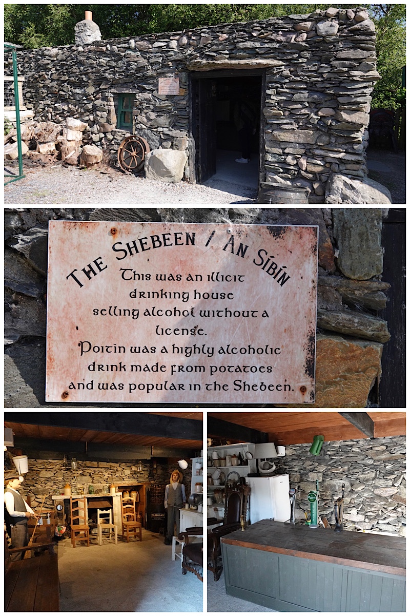
Of course, any village needs a place to quench its thirst!
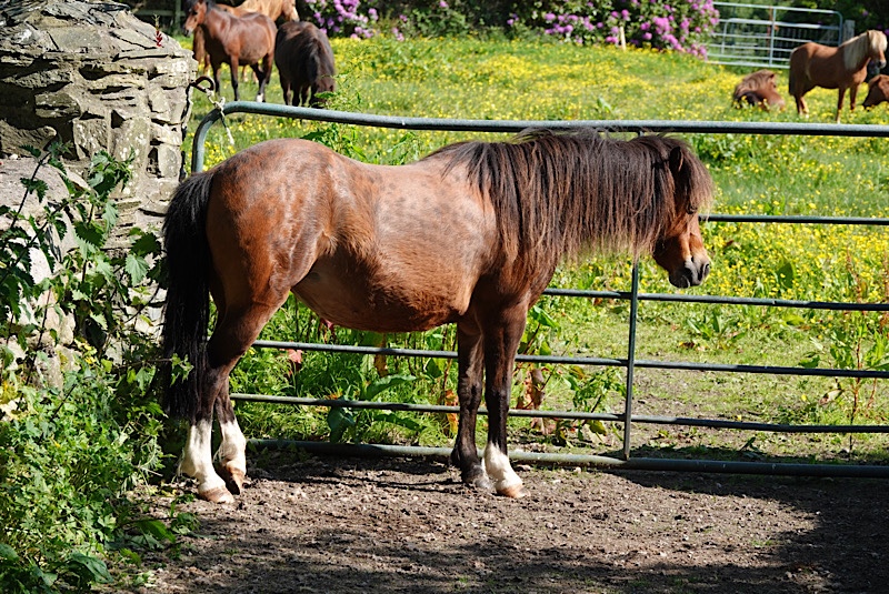
In the museum’s outdoor area were several Kerry bog ponies, a recognized breed native to Ireland.
After leaving the village we enjoyed more miles of green, also stopping at a scenic lookout point over Dingle Bay.

At Cahersiveen, we got off the bus again to photograph the remains of Daniel O’Connell’s birthplace. O’Connell is revered as being the champion of Irish Catholic emancipation in 1829, earning him the sobriquet “The Liberator”.

We got a glimpse of Valentia island, which is both a meteorology station for Western Europe and terminus of transatlantic communication cable from Newfoundland. Our driver joked that no one works inside the meteorological station, because they’re all in the mountains looking at sheep. Sheep grazing high mean good weather, sheep grazing mid-mountain mean be prepared for rain, and sheep grazing at the bottom mean storms on the horizon. Given that we saw sheep EVERYWHERE, and the sun has been shining for days …

Our lunch stop was in Waterville, on the edge of Ballinskelligs Bay. It’s a lovely little resort town filled with hotels, restaurants, and boasting a large rock and sand beach. I enjoyed a locally made Dingle Gin and tonic with my lunch.


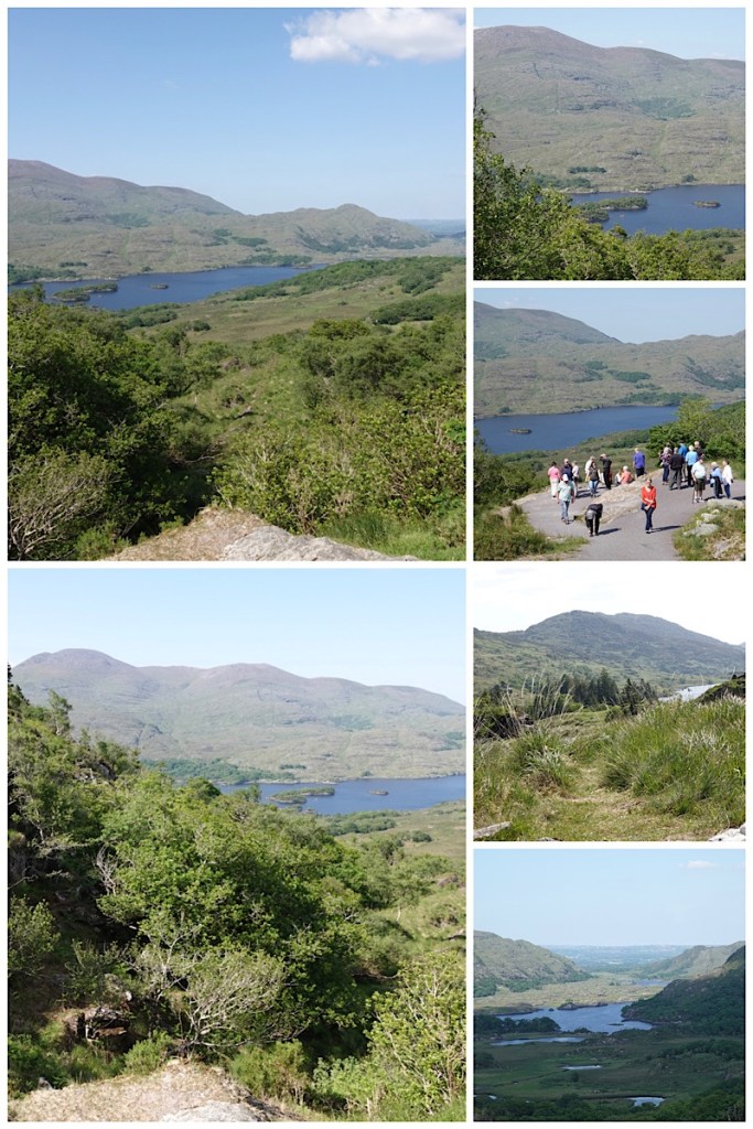
Driving the Ring means lots of short photo stops. At Com an Chiste (Coomakista) we had panoramic views over the Kenmare River, Abbey Island, Deenish Island and Scariff Island. Given Ted’s great grandmother’s name, we of course needed to photograph the statue of Saint Brigid.

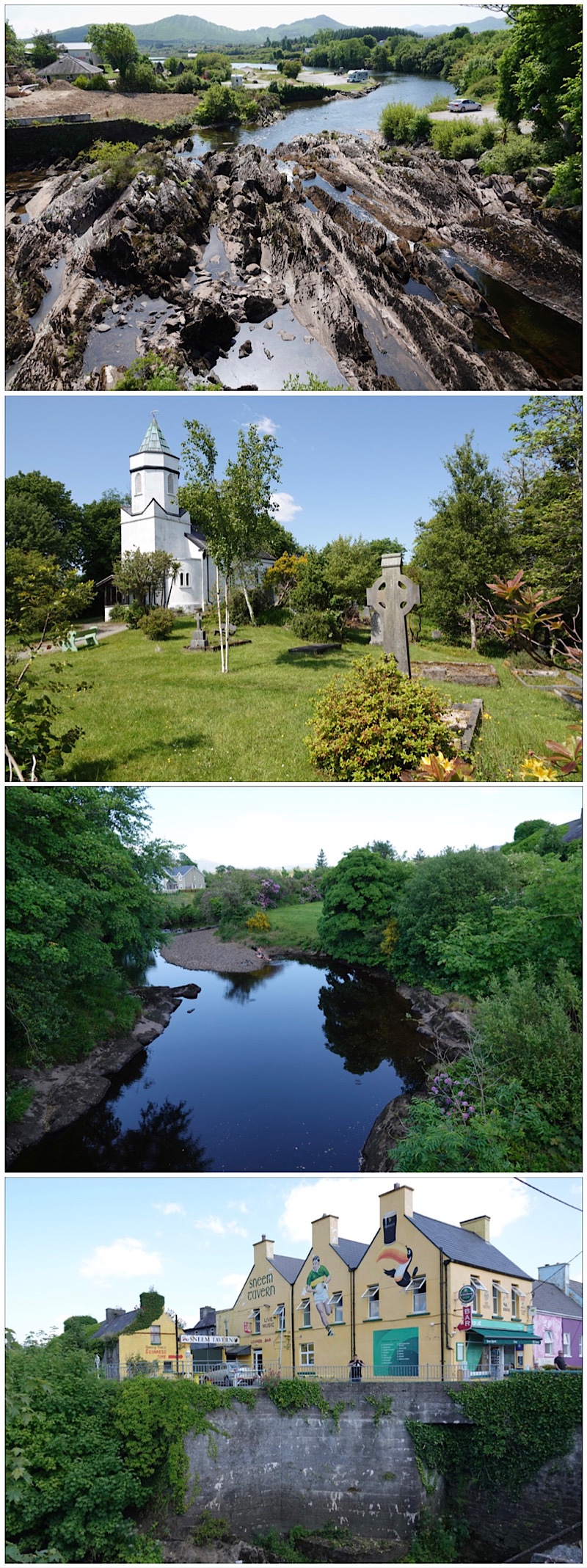
Mid afternoon we were treated to delicious Irish ice cream in Sneem. Ted’s lemon meringue flavour was especially delicious, but I opted for soft-serve vanilla purely because it came garnished with a bar of Cadbury Flake!

We enjoyed our ice creams on the bridge overlooking the very picturesque Sneem River.
Our last photo stop was just before Moll’s Gap at Beaufort/Derrycunihy. A few kilometres down the road is Black Valley, so called because there are portions of it which the sun never reaches. On a day like today, all we saw was stunning green and blue.
After an 8 hour day, mostly driving, we were pleased to have the evening to ourselves for a nice dinner (and another locally distilled gin) before sitting down in our room to go,through the day’s many photos and put together today’s diary/blog entry.

Tomorrow we head to Galway, and the halfway point of our tour, but first a last lovely cup of coffee from our in-room Nespresso machine.


Another nice sunny day. Didn’t know that happened two days in a row in the British Isles. Makes touring and picturing taking much nicer. Did Ted wind up taking his Sony, or are all these iPhone pictures? Either way, very nice!
LikeLiked by 1 person
Ted brought his camera and is responsible for all the gorgeous scenery pics. I’m using my phone for the indoor stuff, food, and “snapshots” for now, until his eye issues get fixed – first triage appointment scheduled for July 10!
LikeLike
Glad he felt good enough to take camera, and glad he has an appointment. Looks like fabulous tour. Thanks for sharing!
LikeLiked by 1 person
What a great time you are having, Rose. You are “encouraging” me…. Sounds like so much fun!
LikeLiked by 1 person