We’re constantly amazed by our surroundings. Here in Tucson, the desert and mountain landscapes are what the best jigsaw puzzle pictures are made of.
When we get up in the morning, the rocky Catalina Foothills visible from our veranda are framed against a vibrantly bright blue sky in the sunshine – and in January it is ALWAYS sunny! Monsoon season rains with their indigo skies and streaks of fork lightning are months away. As the day progresses, the mountains change colour as the light shifts, turning from sandstone, slate and green in the morning to pinkish by midday, a rich pink-gold copper in late afternoon, and then quickly transitioning through dusty rose and lilac into grey as twilight arrives. Those same colours appear on the stucco and painted brick buildings here.
About 15 miles in each direction to the east and west of Tucson are the two halves of Saguaro National Park: the Rincon Mountain District and the Tucson Mountain District, respectively. Park admission is good for a week at both sites, so they were our main focus this week.
Heading west we drove along the Gates Pass, a winding mountain road built in 1883 by pioneer, saloon owner and rancher Thomas Gates as a shortcut through the mountains to his carbonate mine in the Avra Valley. The 15mph speed limit around the blind curves is definitely there for a reason.
Part way to the National Park is Tucson Mountain Park, with a lookout point located on one side of a bowl-shaped volcanic crater, surrounded by the mountain range. When the area became a park in 1937, several stone buildings were erected on the hills.

The Tucson range is the equivalent of “tree-covered”, only the “trees” are 20 to 30 foot tall saguaro cacti. The density of the saguaro forest surprised us; it is similar to the density of old growth forests like Cathedral Grove on Vancouver Island. Where the B.C. forest floor is covered in pine needles, moss, ferns and nurse logs, here the forest floor is sand and stone with scrub grasses, bushes, and smaller cacti growing in discrete clumps. Water is at such a premium that the desert plants space themselves, sometimes by secreting toxins from their roots that keep other plants from encroaching on their territory.
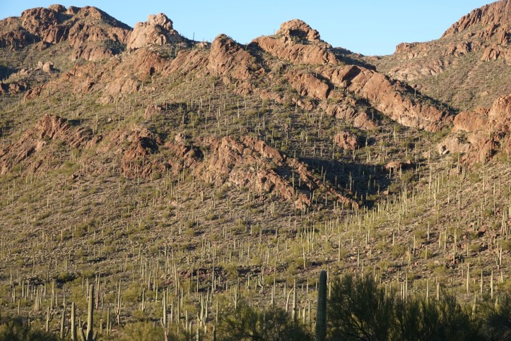
Further along we reached the National Park proper, with its miles and miles of dirt roads, walking and hiking trails. The trail map suggests how much water you should carry, since the last place to refill your water bottle is at the visitor centre. There are a few restrooms in the park, but none with potable water. If, like us, you remembered your hat but didn’t think to bring a water bottle, you can buy a reusable one and fill it, but they don’t sell bottled water.
Since we only wanted to spend about 3 hours, the park ranger suggested we walk the Valleyview and Wild Dog Trails, where we were struck by the sheer diversity of desert plants. There were lots of giant saguaros, but also hedgehog cacti, teddybear cholla, mesquite, palo verde, bursage, burroweed, brickelbush, juniper, acacia, ironwood, ocotillo, creosote, buckhorn cholla, pencil cholla, jumping cholla, staghorn cholla, prickly pear (green and purple), organpipe cacti, and deer-grass…. and that’s just what we could identify with the help of the interpretive charts!

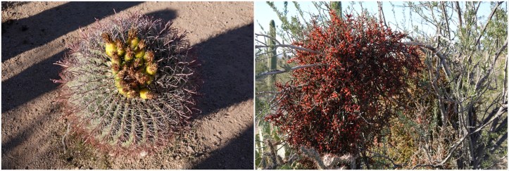 Later in the spring, there will be bright colours from cactus flowers, but now there is “just” green, the occasional yellow fruit on the barrel cacti, and the small dark red berries of the desert mistletoe (above).
“Just” green! Sage, mint, olive, lime, fern, pistachio, seaweed, basil, pear, avocado, jade, asparagus, army…. think of a shade and it’s here in the desert and, like the mountains, each one changes hue with the light. In the afternoon with the full sun beating down, the colours bleach out a bit – or maybe it’s our eyes that can’t handle the intensity of the light. As the sun starts to set, the paler greens turn silvery, and the darker ones seem to become even more vibrant. It’s breathtaking.

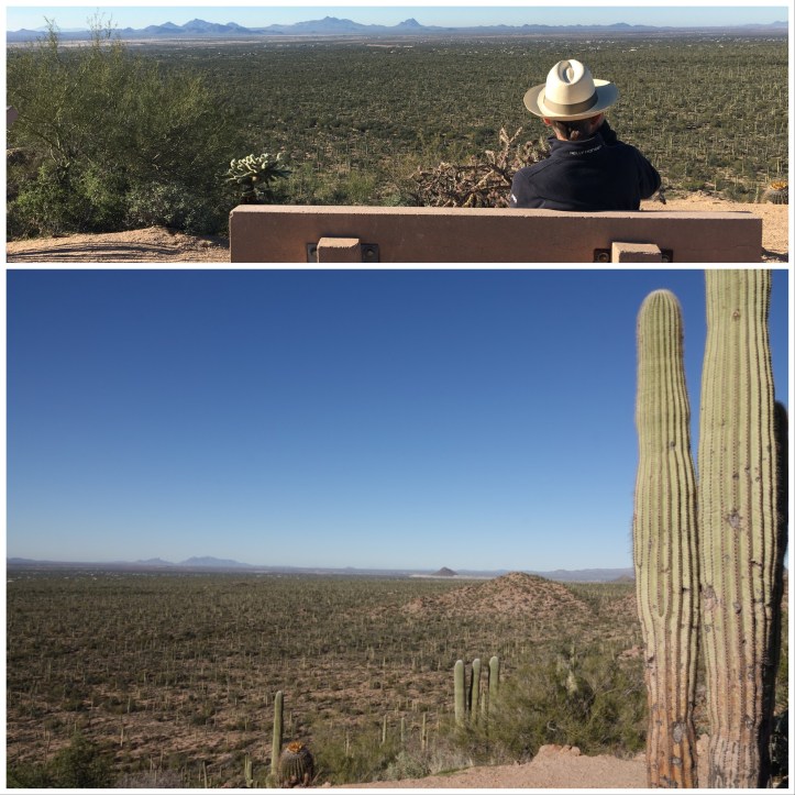
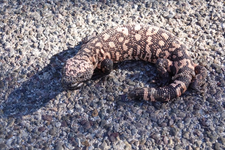
The Rincon Mountain eastern portion of the National Park is reached by a far less twisty route; since it is just outside the Tucson city limits, the drive there is through built-up residential areas. Even the roads inside the eastern park are paved, with regular lookout points where you can pull off and take photos…. or just stop on the one-way road to photograph a sunning lizard!
The terrain and the walking trails are much stonier than in the western park. Here there used to be ranches, lime kilns (below), and the Loma Verde copper mine, and you can see remnants of those enterprises scattered throughout the area.

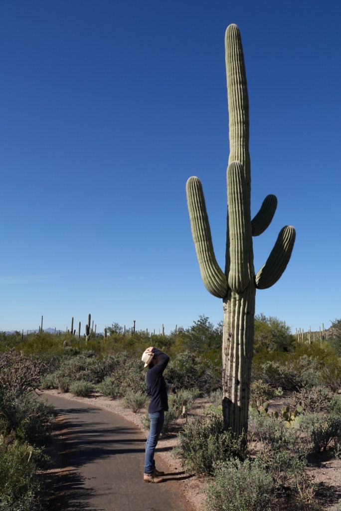
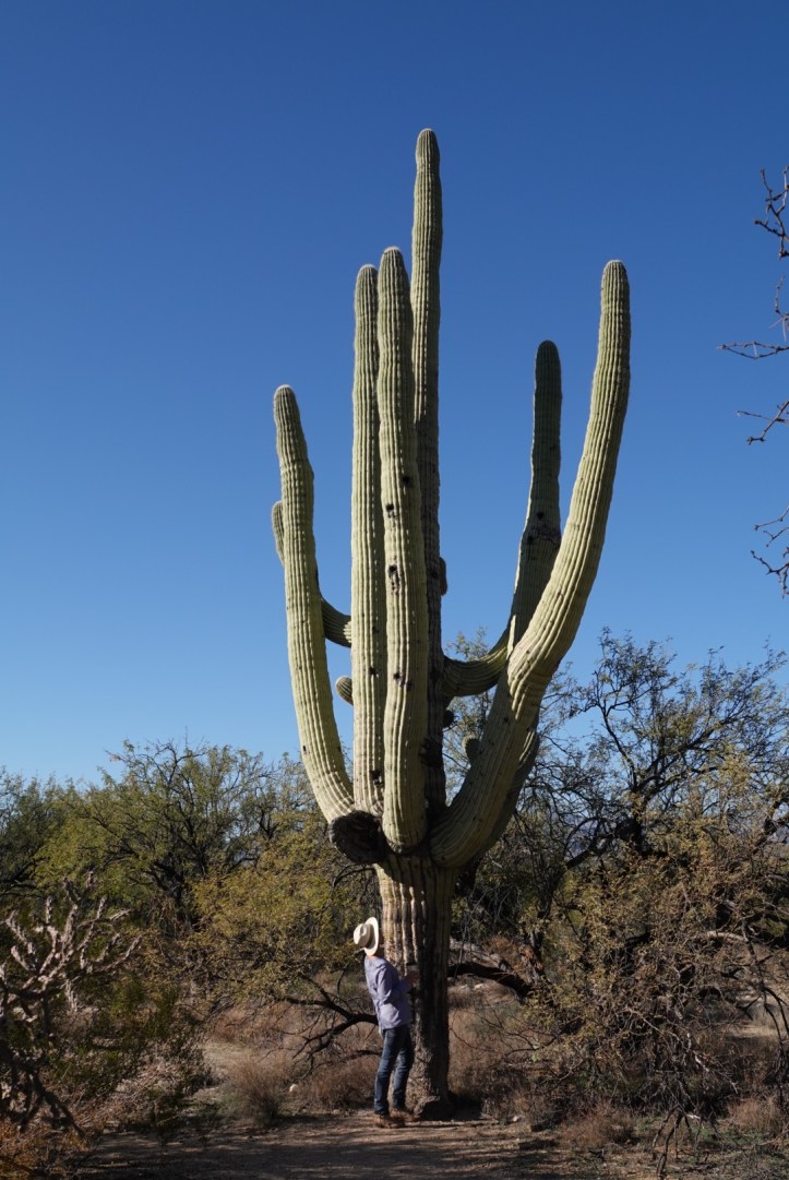
The vegetation is similar, and yet different. There are far more trees: palo verde, mesquite, and creosote. The prickly pear and cholla are more abundant and larger. The biggest difference, though, is the saguaro. There are fewer in this park, but those that are here are much older and thus much larger. We learned that a saguaro does not produce its first “arm” bud until it is between 60 and 75 years old. A 6 foot tall saguaro is about 35 years old – there are specimens here that are 150 years old, 50 feet tall, with multiple limbs.
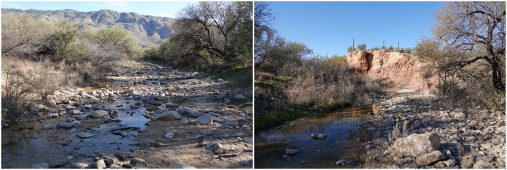
On our hike we crossed water twice, in the Monument Wash and the Loma Verde Wash. Both are shallow rocky creeks now in dry season, but turn into road-flooding rivers in monsoon season. On either side of the wash, plants grew closer together and were a deeper shade of green.
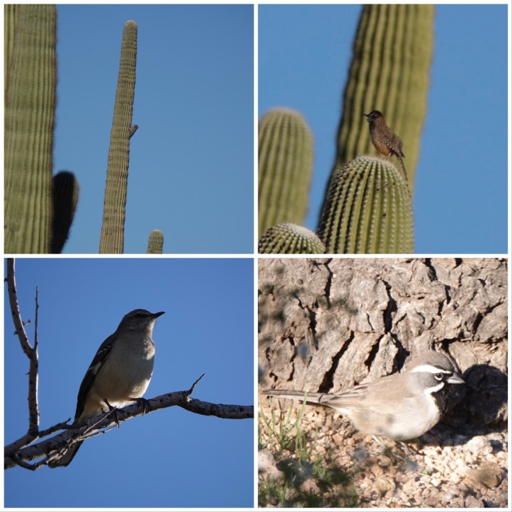
The area is too dry to attract birds, so our next hikes will be Sabino and Madera Canyons, which the park rangers told us are the best birding spots. Fingers crossed!

I’ve just been rereading. The long distance pictures of the cacti is amazing. It’s a forest!!! Jeff was surprised at the vegetation in the desert when he went to Arizona Love you lots
>
LikeLiked by 1 person
And…… I LOVE YOUR HAT!!!!!!
B.
Sent from my iPhone
LikeLike
And to think I only had to travel to Ecuador to find one I liked!
LikeLike