Today we headed to Cabrillo Monument National Park, which combines colonial history, naval history, military history, and natural history in one absolutely stunning location. To make our exploration of the park even better, we had glorious weather – which we will NOT have when we return to cold and overnight snow flurries in BC tomorrow.

Getting to the park involves driving through Naval Base Point Loma. The current base only dates to 1998, but its history began in 1795 when the Spanish began building a fort on the land which is today known as Ballast Point. That fort, named Guijarros, was finished in 1798 and abandoned by the Mexicans in 1845. Unlike many US military sites that we’ve driven through or visited, we did not need to stop at any kind of checkpoint. Our MTS transit bus picks up and drops off on the base.
Fort Rosecrans National Cemetery was one of seven national cemeteries created between world wars, 1934–1939. It was the Army’s first major expansion since the Civil War directed at serving a growing veteran population and the rapidly depleting burial space at existing national cemeteries. Before being designated a national cemetery, though, it was already the final resting place of soldiers killed in the Mexican American War (1846-48) who were re-interred here in 1892, and the 60 sailors killed in the July 21, 1905, boiler explosion on the USS Bennington.

More than 120,000 people are buried here, most in graves marked by standing stones. Ted and I were privileged to see the changing of the guard at Arlington Cemetery (400,000 graves) many many years ago; I remember feeling overwhelmed by the row upon row of gravestones that formed perfectly straight lines no matter from which angle they were viewed. This cemetery is the same.
The cemetery is one of more than eighty VA national cemeteries that use upright headstones and flat grave markers in separate burial sections. It was designated a California Historical Landmark in 1932, and listed on the National Register of Historic Places in 2016. It has been closed to new burials since 2014.

Even just whizzing past on the bus we noticed the 60-foot-tall obelisk dedicated to the men who lost their lives on the USS Bennington. The obelisk was completed in 1907 and dedicated on January 7, 1908. Placed as it is on a prominent hill, it is visible for miles at sea. Sadly, noticing it from the bus and actually being able to get a photo are two very different things.
Side note: one of the unexpected bonuses of taking public transit to the national park was not paying an entrance fee at the gate. Who knew? Our $23 USD per person monthly seniors transit pass really got a workout during our stay in San Diego, and paid dividends right until our last day.
But on to the park.
There is a lovely visitor’s centre and gift shop, a small well put together museum about Cabrillo’s voyage of discovery, and a theatre that rotates 4 different movies on history and the area’s wildlife (including the grey whales that migrate through). I peeked into the museum, and we bypassed the movies, because our focus was on the bayside trail hike.

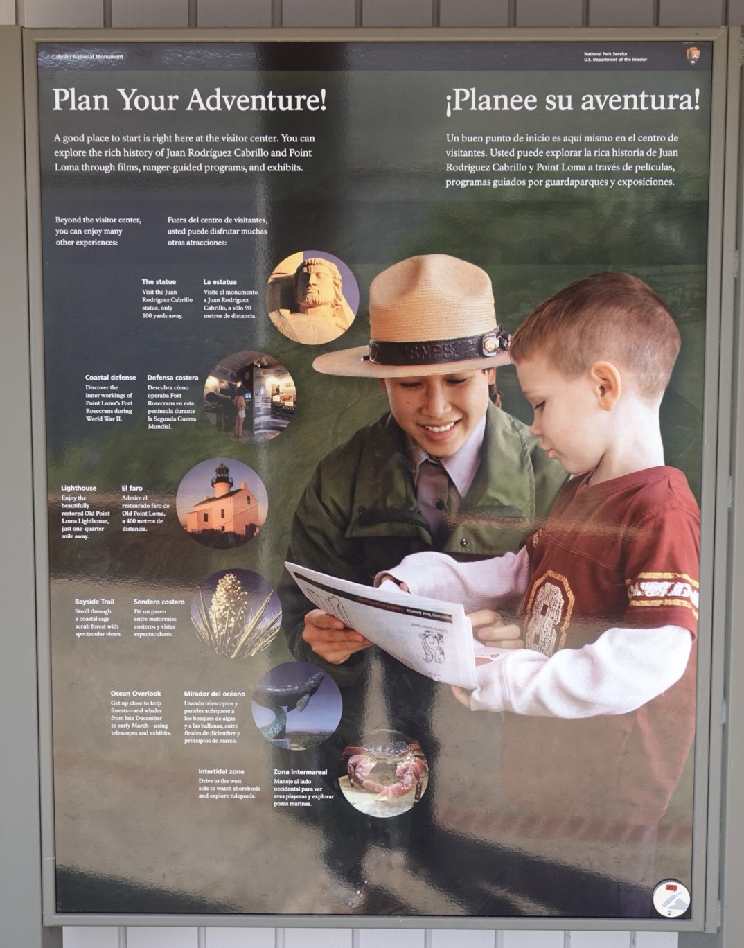
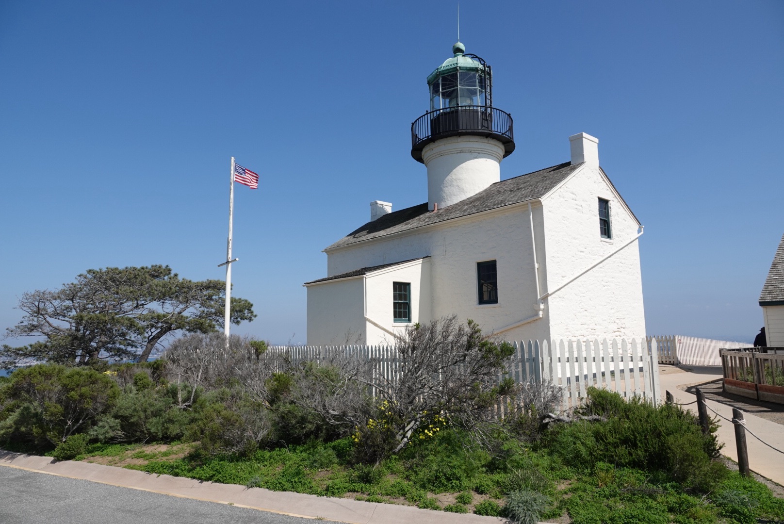
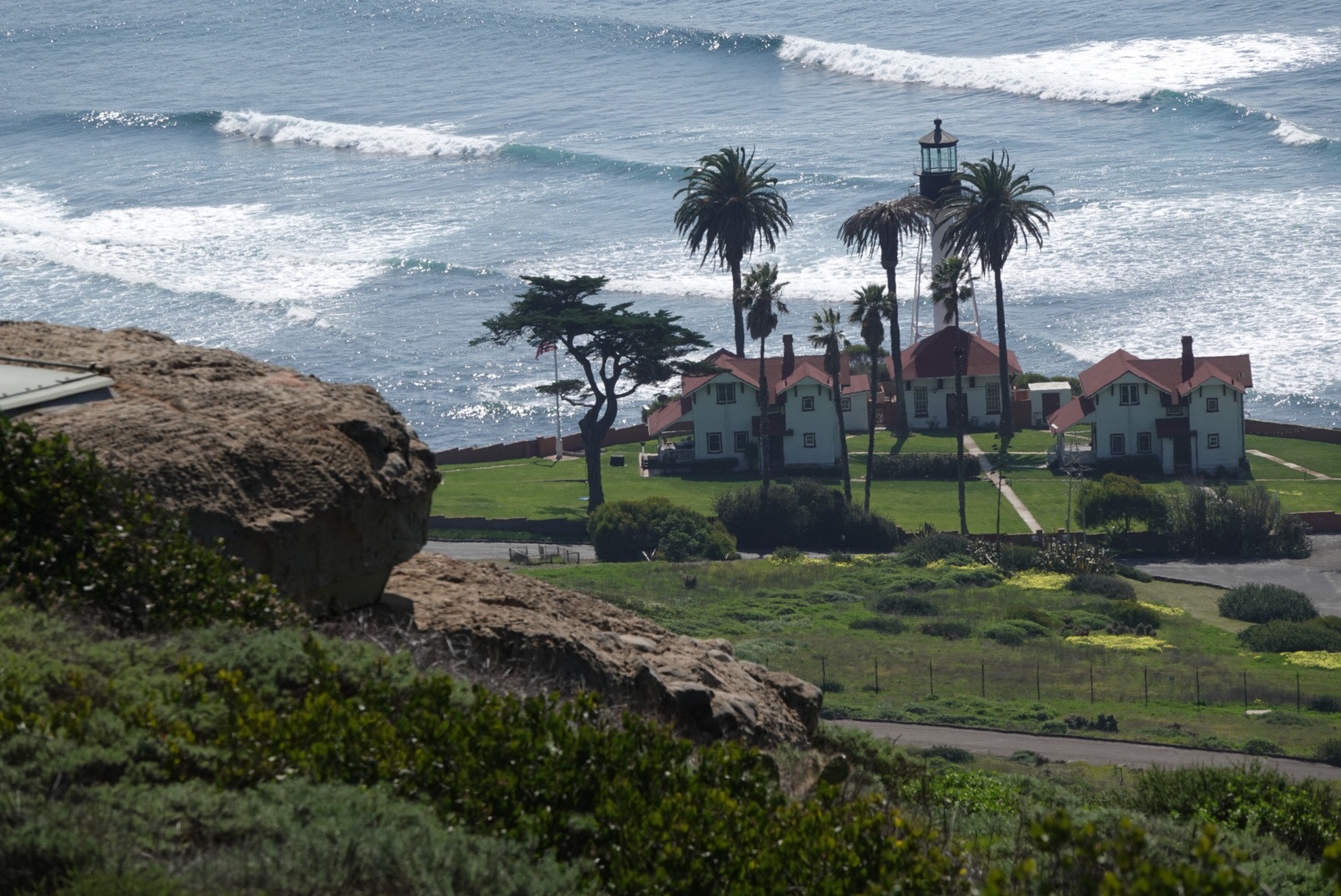
We started at the Old Point Loma Lighthouse, which has been restored to its 1880s appearance, and presents life as it was for the lightkeepers and their families.
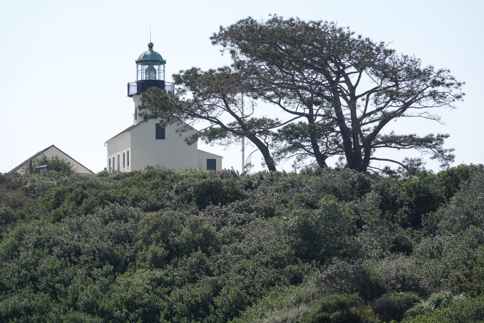
I couldn’t help but compare the lighthouse to the windmills we toured in Kinderdijk in the Netherlands. Episode 88 – Kinderdijk. While both buildings had a central spiral staircase in common, at Point Loma the accommodations seemed quite spacious, at least in part because the lighthouse itself was rectangular, and the lighthouse keepers did not have huge families. In Kinderdijk the stories we heard of families with up to 8 children living in the quirkily shaped rooms necessitated by a round building made the accommodations seem horrendously crowded.
In the adjacent Assistant Keeper’s Quarters, interactive exhibits tell the story of the Lighthouses of Point Loma. What I found most interesting was the information about female lighthouse keepers. As far back as 1776, women were employed as keepers, one of the few non-clerical jobs that existed for women.

When you think about their duties, it’s even more impressive to think about them being performed while wearing long skirts, corsets, and bustles! Imagine climbing those stairs! Even in jeans and running shoes, they’re a challenge – and the highest access to the light itself is closed to visitors.

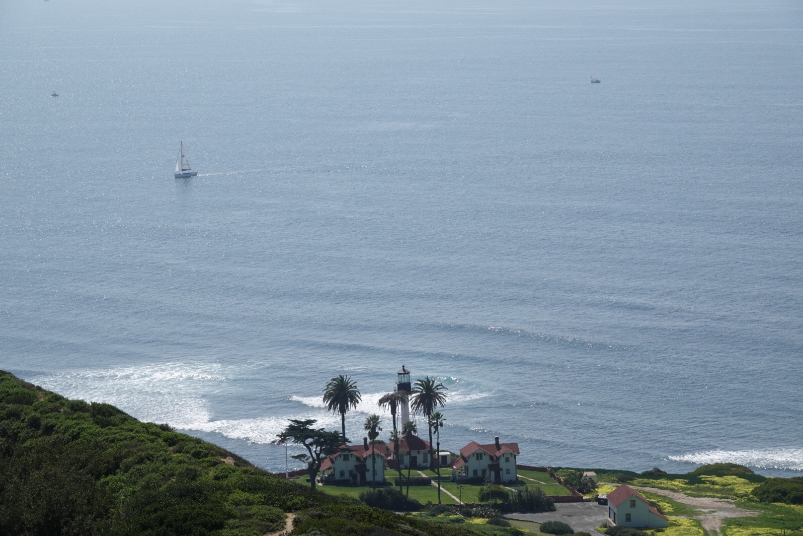
From the old lighthouse we also had a vantage point over the new one. The “new” lighthouse was first lighted on March 23, 1891, in a location much better suited for visibility than the original. The light was automated in 1973, and its latest light installed in 2013. Although the light itself is automated, the lighthouse is now a residential area for Coast Guard officers and is off limits to the general public.
One of the paths from the old lighthouse took us to Whale Overlook, high above a kelp forest. Although we didn’t see any whales, we did read about the kelp ecosystem’s importance, and had a quick picnic lunch.
Then it was on to the 3.1 km/1.9 mi roundtrip Bayshore Trail, running steeply from the lighthouse hill to the bay.


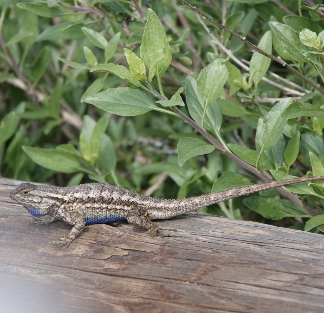
We hadn’t seen rattlesnake warnings since our 2019 drive through Oklahoma. They’re an excellent incentive to stay on the marked trail! Fortunately, the only quick-moving reptiles that crossed our path were adorable little geckos.
It would be easy to forget that this area was a military installation in WWII, since it is so green and peaceful now, but there is evidence if you know what to look for. An interpretive sign beside an innocuous looking door along the trail identified it as the location of a searchlight that could be pulled out at night to scan the bay and the skies above it for enemy craft. Another sign identified a camouflaged green shed as the power station for that same searchlight.
We noticed that there seemed to be two distinct types of plants along the trail: desert-like scrub and cacti, and lush flowering bushes among evergreens.
The park does an excellent job of satisfying visitors’ curiosity; partway down the trail we found a sign explaining the difference between plants living on the sunny sides of the canyons vs those on the cooler shady sides.


Vegetation and lighthouses aside, the park’s main attraction is the monument of Juan Rodriguez Cabrillo (João Rodrigues Cabrilho in Portuguese), the Portuguese explorer who “discovered” San Diego in 1542 – although he named it San Miguel. The ship in which he made his journey, 50 years after Columbus reached the east coast, was only 125 feet long. That is really put into perspective by the nearby naval base’s 1092 ft long Nimitz class aircraft carrier. I’m pretty sure I know on which ship I’d rather battle ocean waves. That said, the dozens of sailboats in the bay didn’t seem to envy the heavily armoured combat ship sharing the bay with them despite their size disadvantage.

The 14 foot tall monument of Cabrillo at the park, a gift to the city from Portugal, really does bear the expression of an intrepid traveller. It stands high above the bay, but faces toward the land.

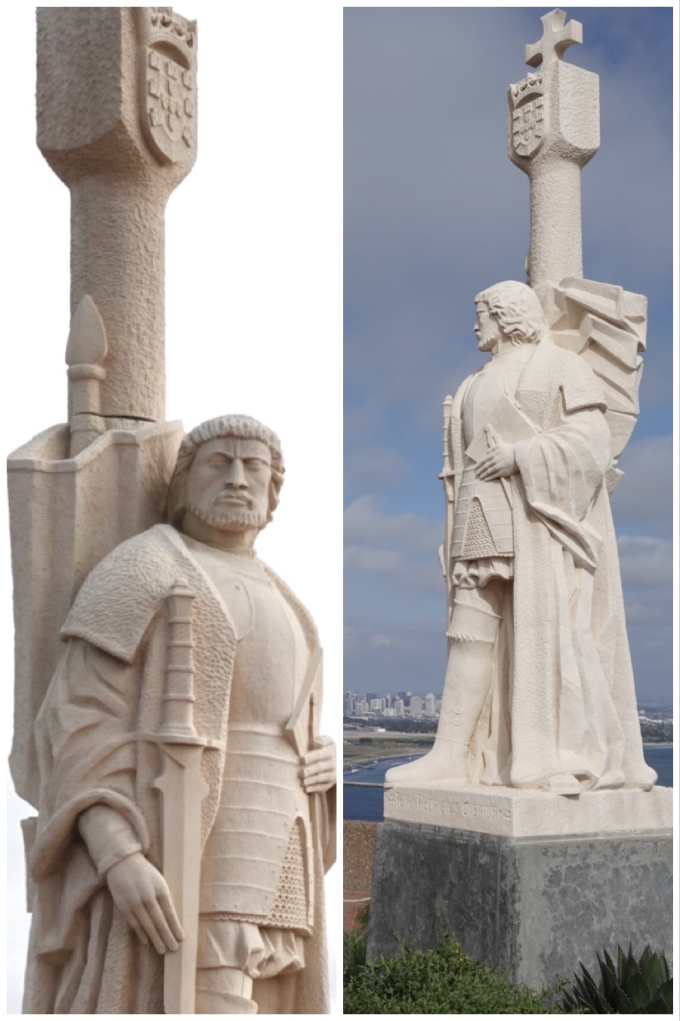
It’s too bad he’s missing out on the gorgeous view behind me of the city that has developed where he landed.

Our San Diego month ended with a lovely dinner with our VRBO hosts at their (and our!) favourite local Mexican restaurant, La Puerta. It was a fun evening of interesting conversation with interesting people. Being “nomadic” has its advantages, and making new friends all over the world is definitely one of them.
And now (with apologies to John Denver)… all our bags are packed. We’re ready to go. Leavin’ on a jet plane. Back in BC tomorrow.
